The following diary was regularly updated between October 2008 and April 2011 - by Paul Keen
(owner & guide for Wallaby Tracks Adventure Tours) so the public could be informed of what they
will see during their visit to this beautiful part of South Australia known as the "Flinders Ranges" and
"Lake Eyre Basin"
Today this diary provides a fascinating history of the water levels and rainfall over that time frame .
_____________________________________________
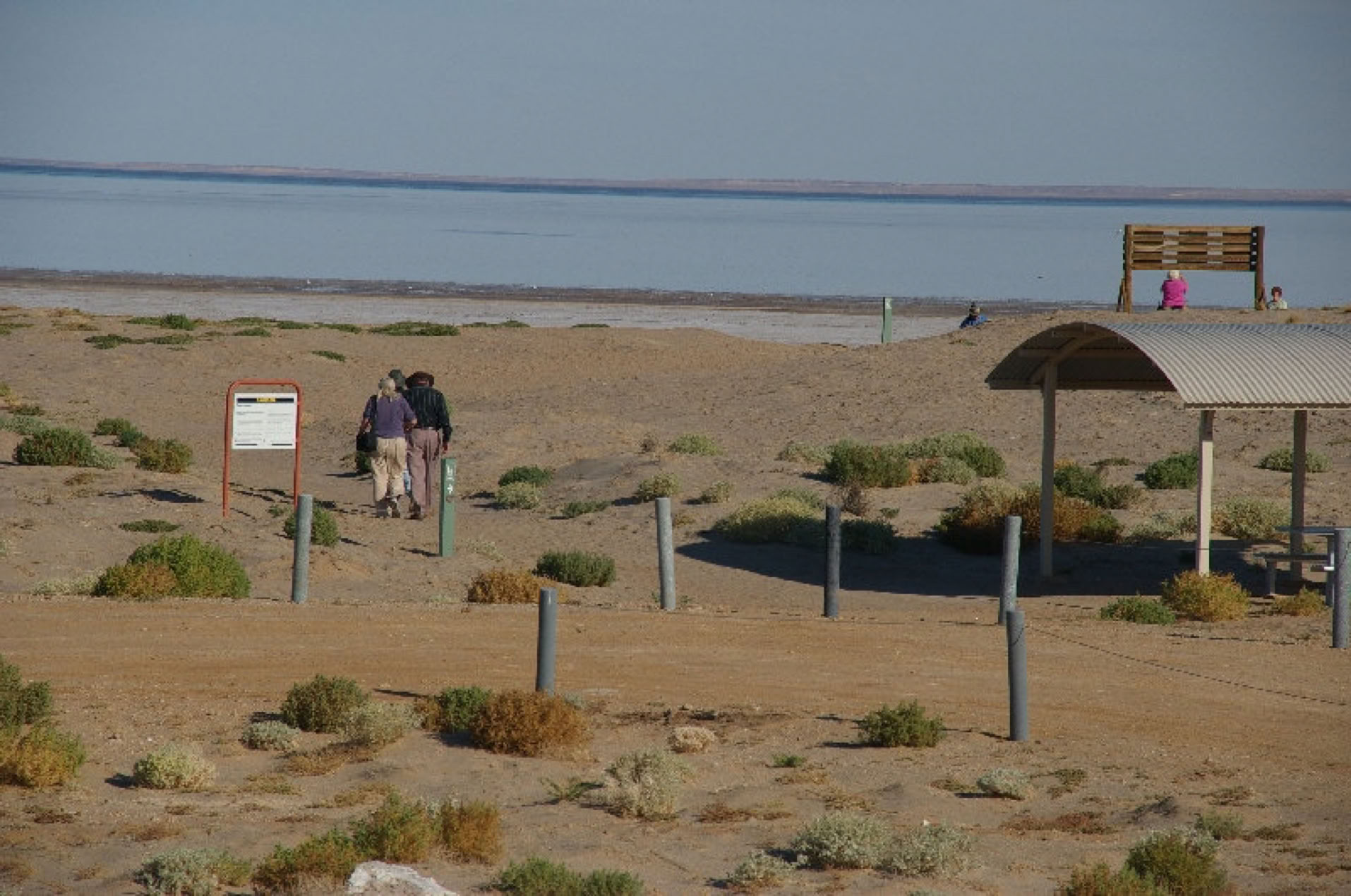
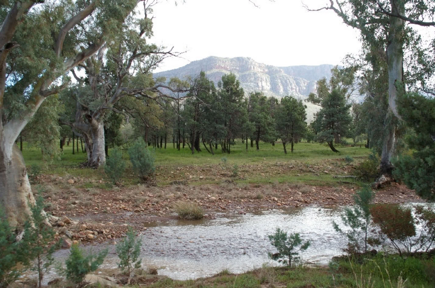
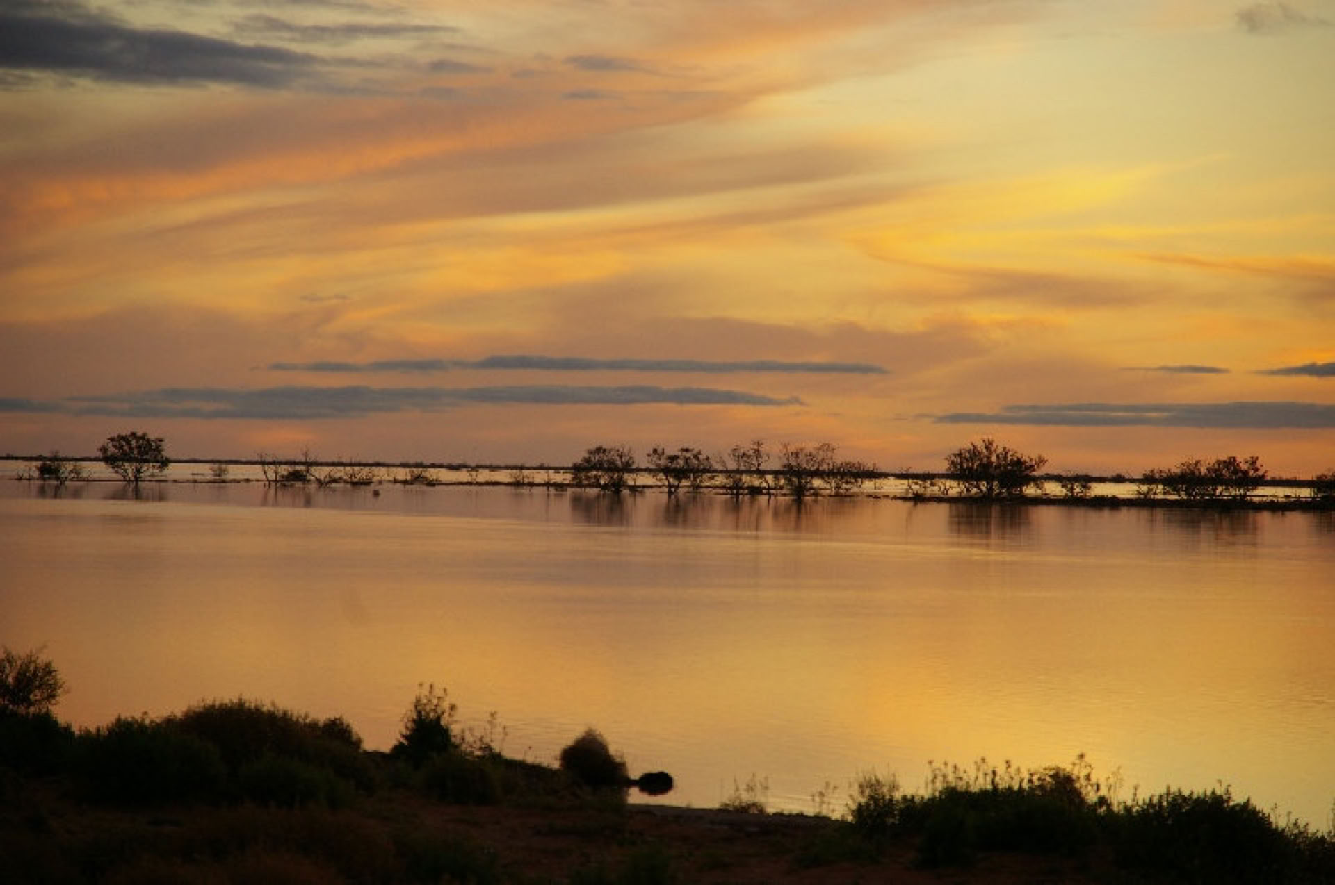
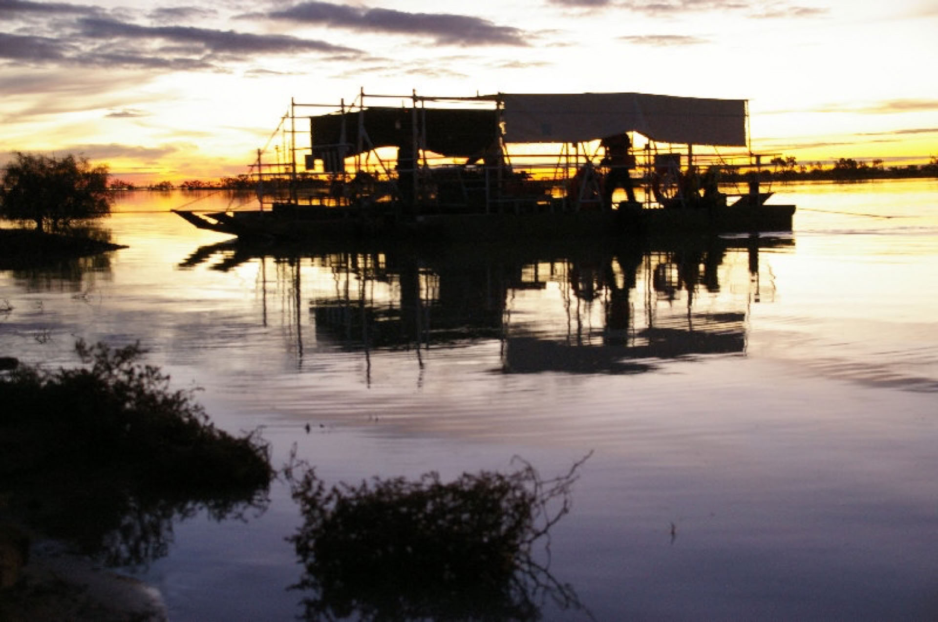
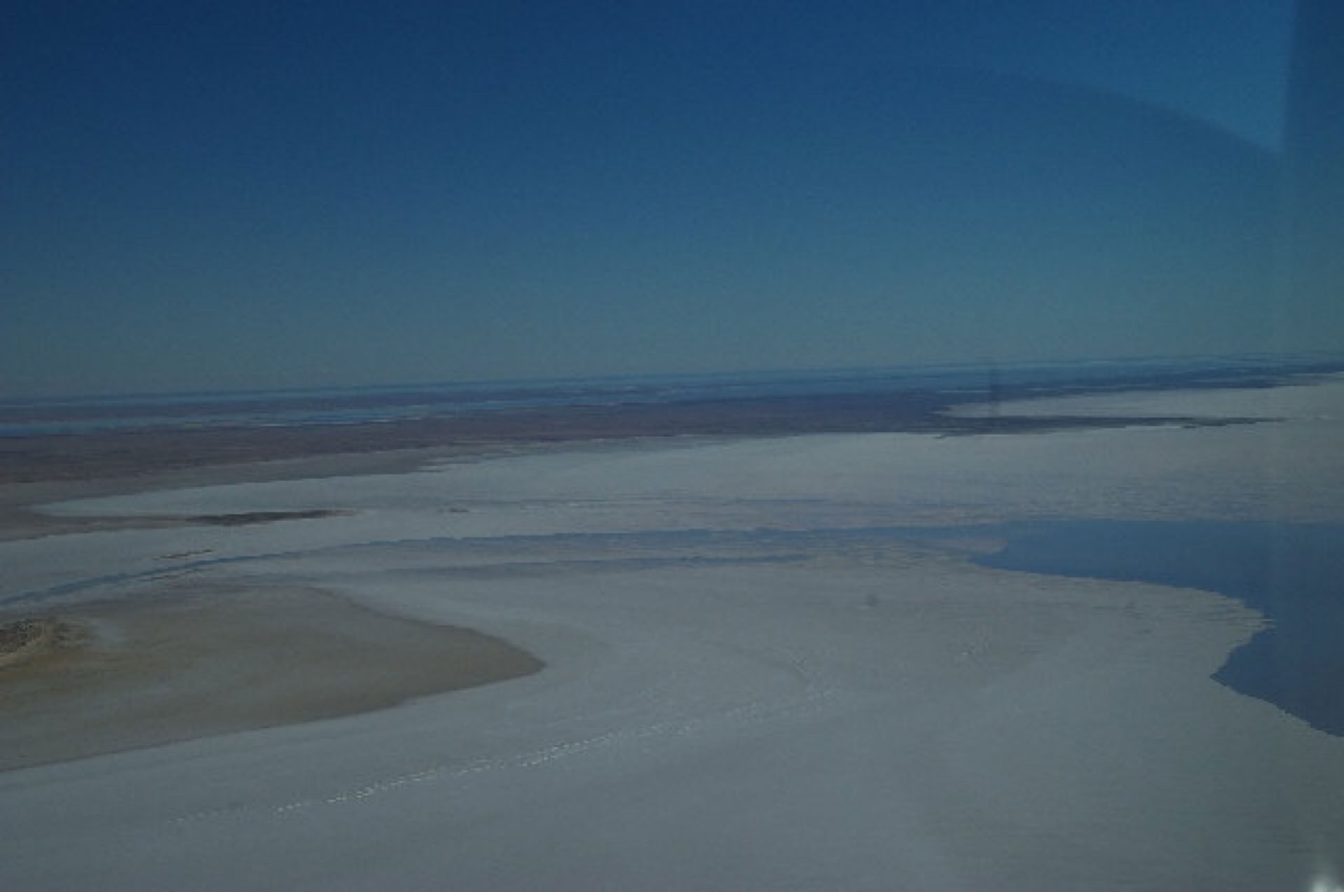
** NEW UPDATE: 14/04/2011 ** Pelicans at Halligan Bay, Lake Eyre North
I'm currently on tour (AHT08ME) and updating from Arkaroola Sanctuary whilst my guests are enjoying their spectacular Ridge Top tour.
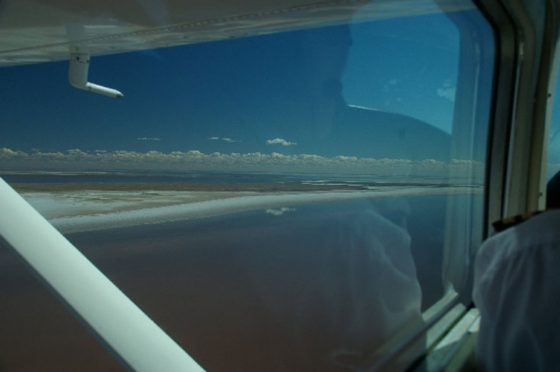
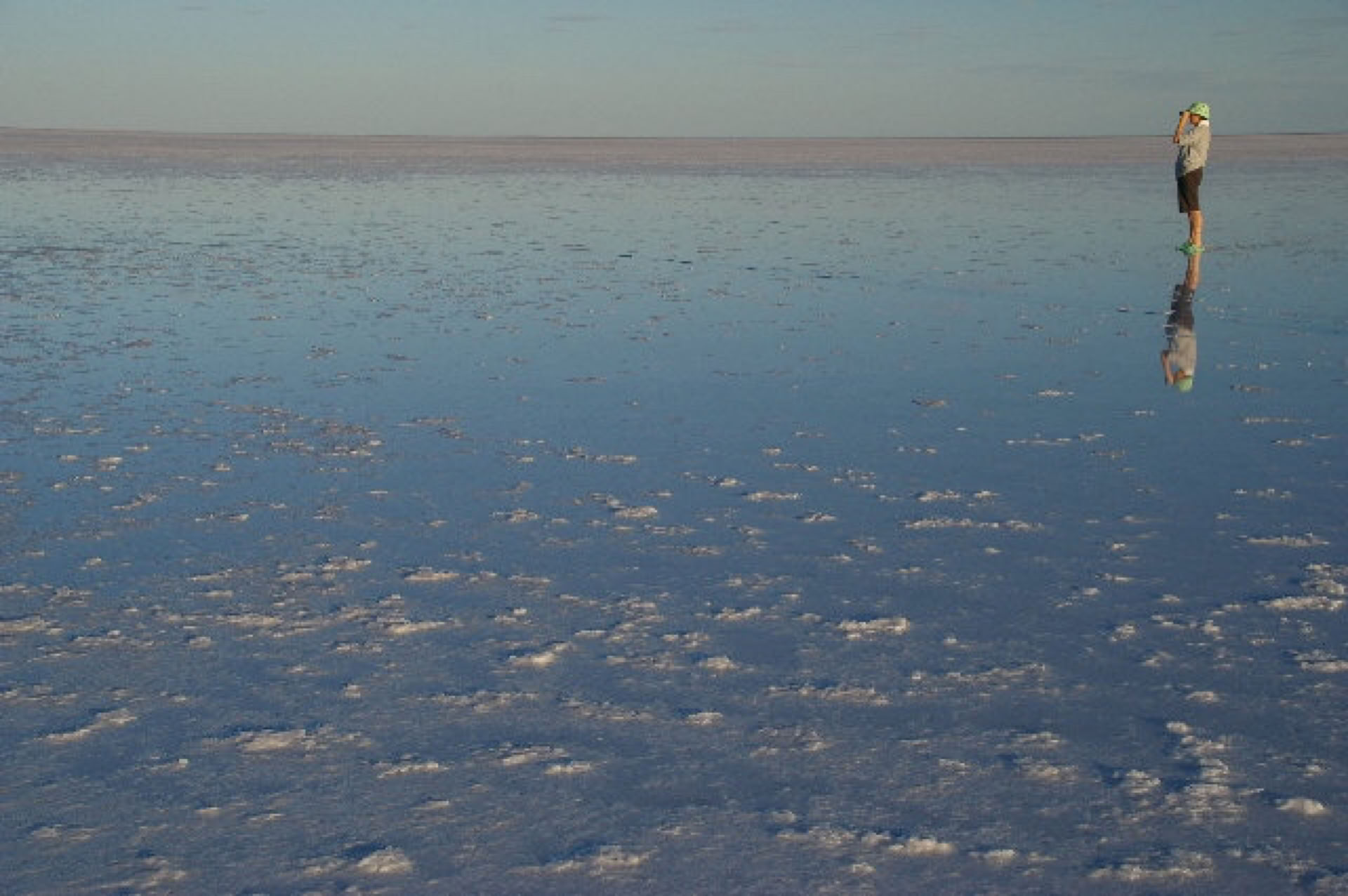
On Tuesday my guests had perfect conditions for their 1 hour Lake Eyre scenic flight followed by a land visit by 4WD to Halligan Bay. This was highlighted by the sighting of a flock of Pelicans appearing as a black spot far on the horizon to fly directly to where we were standing on the waters edge only 50 metres from the shore. We counted approx. 50 Pelicans. The base of Lake Eyre North was firm to enable us to remove our shoes and actually walk in the water where there was abundant life of very small fish, making a perfect food source for the birds. This tour has also been special as we have sighted a total of 3 Dingoes in very healthy condition.
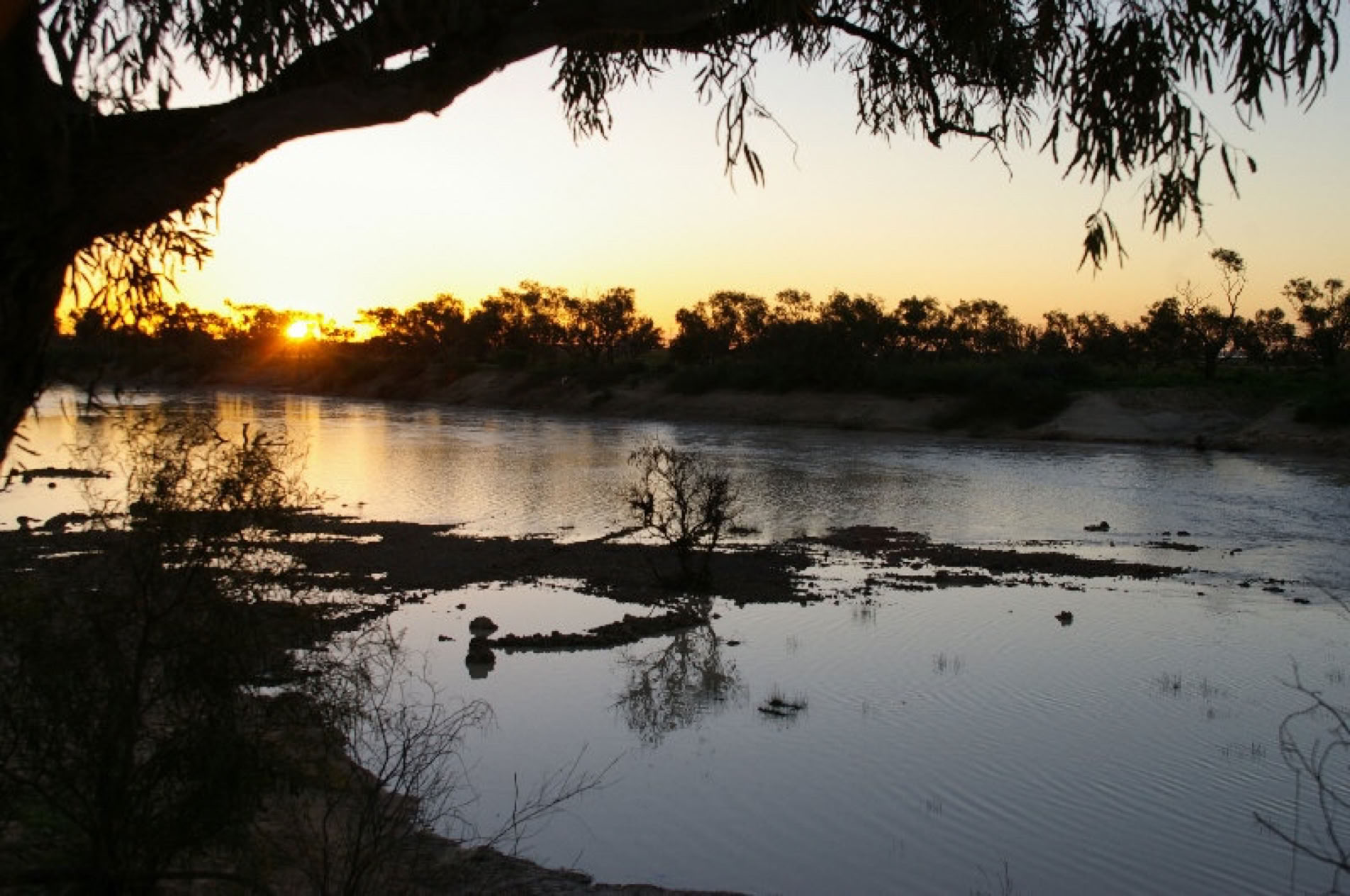
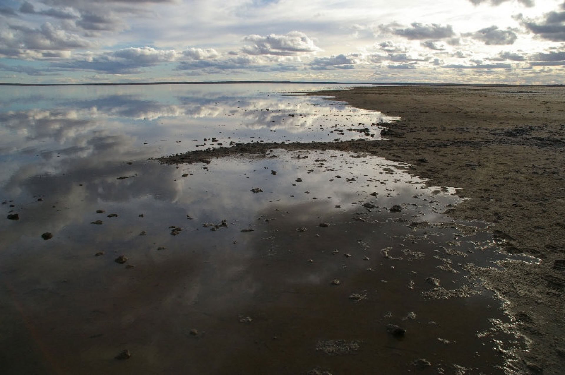
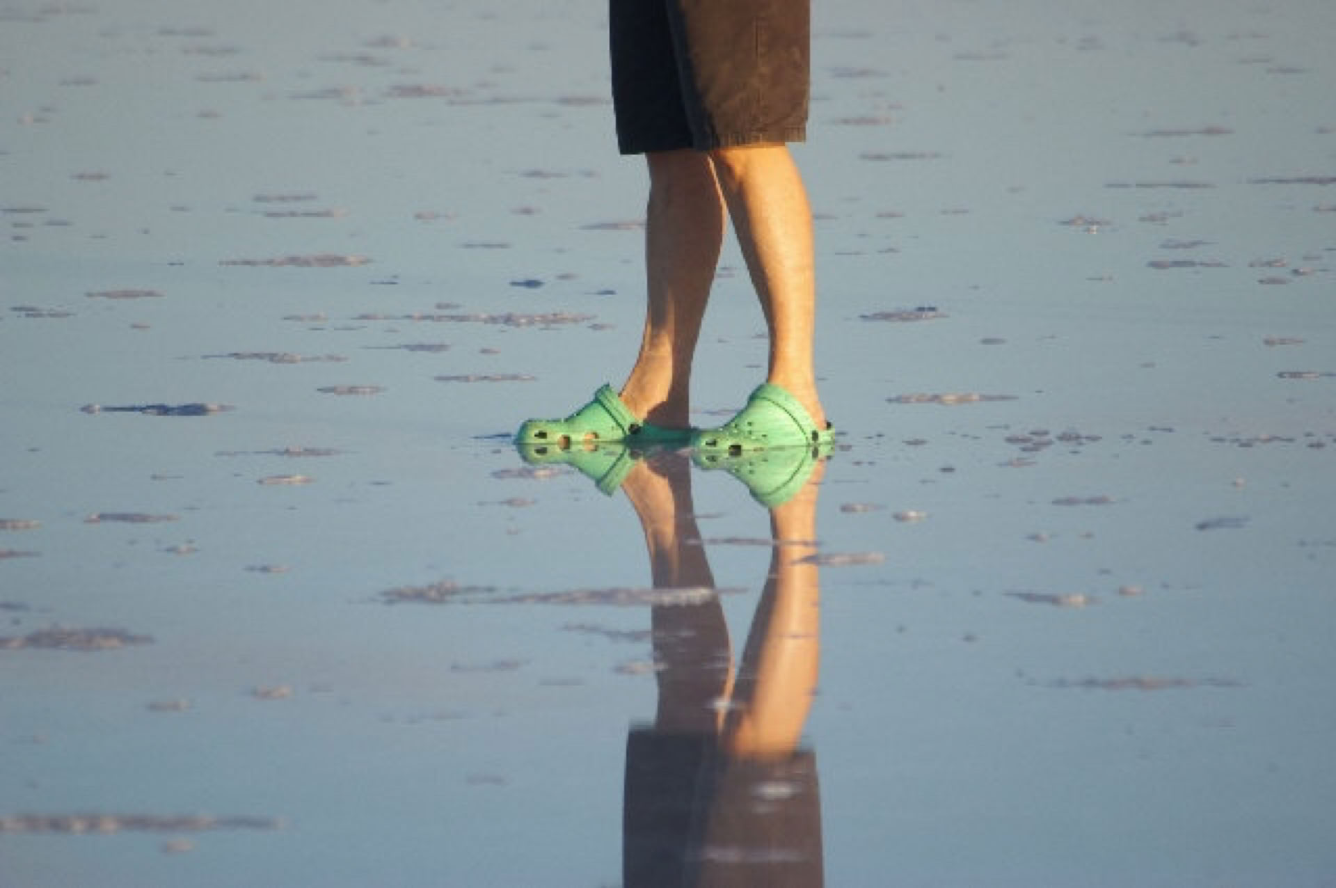
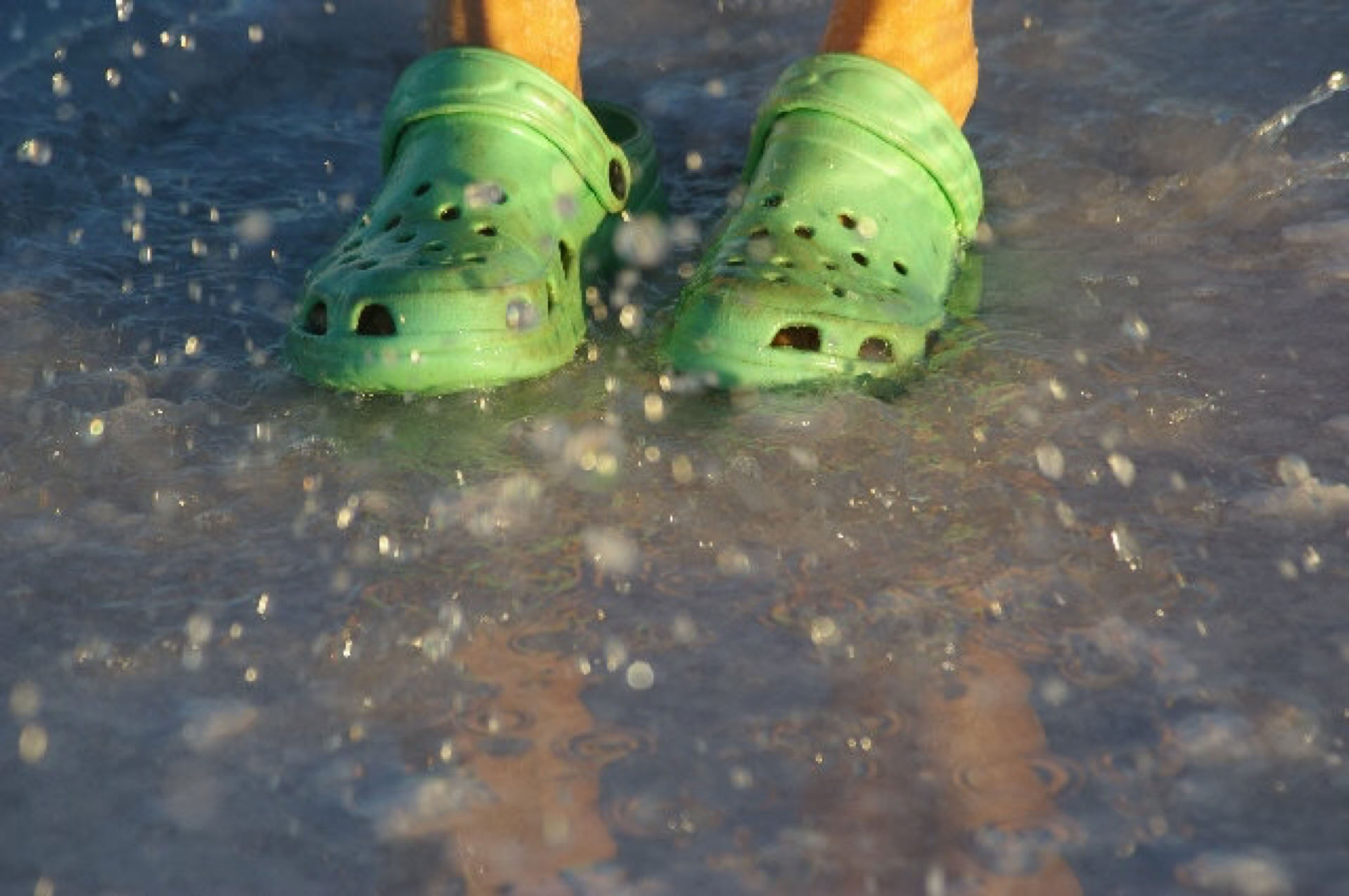
"High Tide " (12/04/2011)
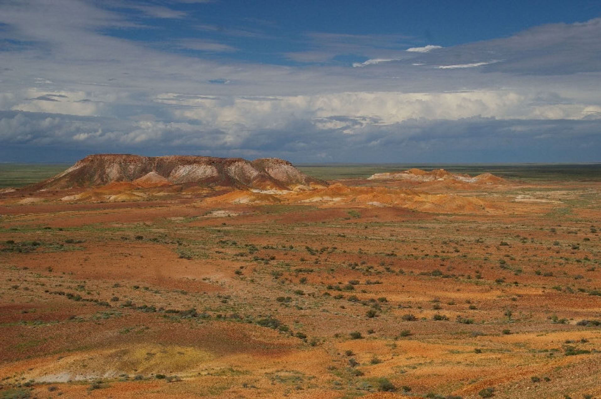
Colourful "Breakaways", Coober Pedy (11/04/2011)
26/03/2011 Lake Eyre South FULL
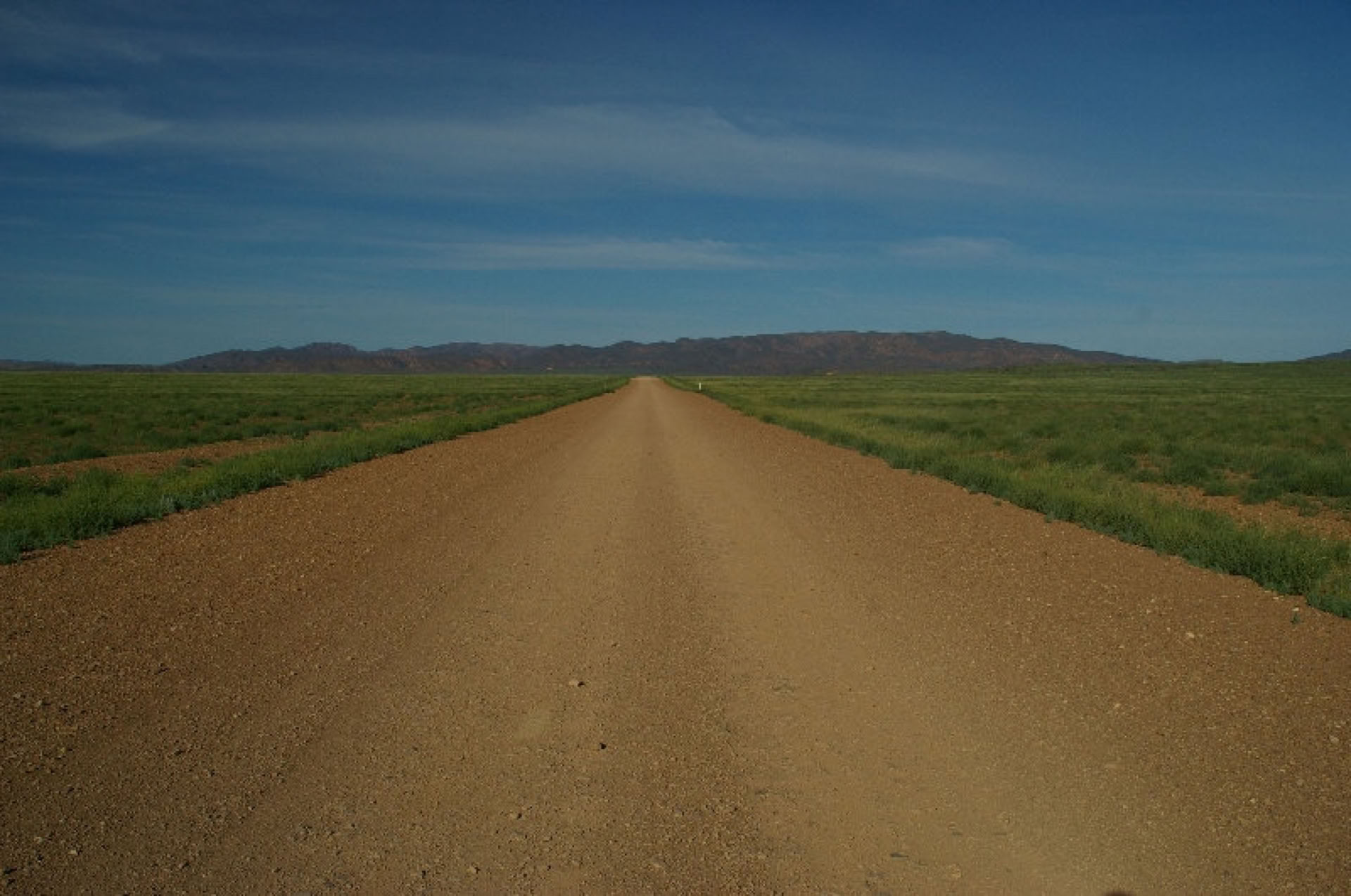
After A VERY busy start to the new season and two visits to Lake Eyre I have to say the whole of Outback South Australia and Flinders Ranges has never look so good.
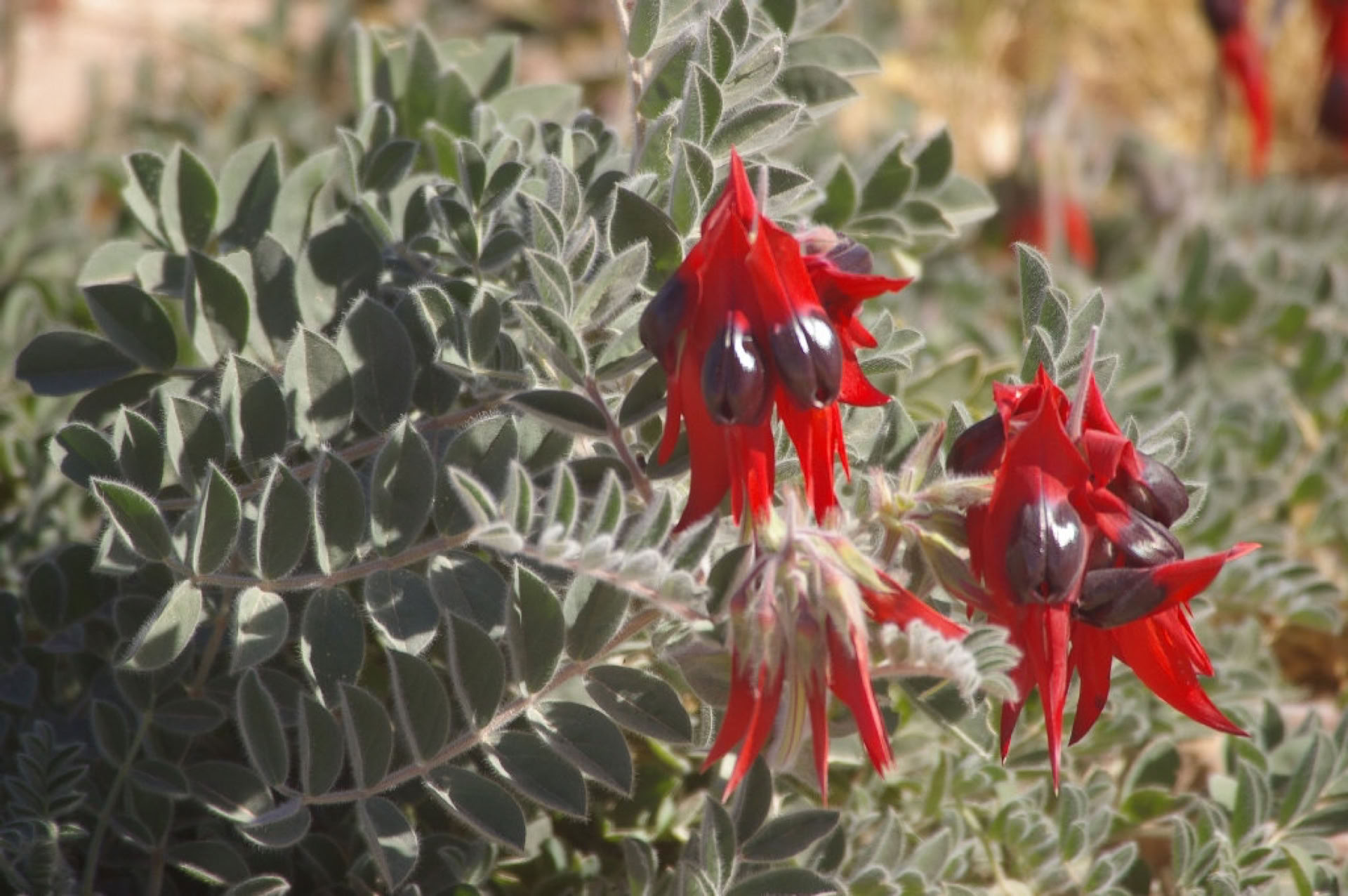
I have stopped at some known locations for Sturt Desert Pea to find new plants looking very healthy meaning there will be more carpeting of red again this year.
May is very busy for tour bookings and June is filling steadily.
Due to poor lighting (cloud cover) I was not happy with any recent photos to post on this page.
22/02/2011 Lake Eyre - 3rd year in a row
I am still pinching myself that nature has had 2 attempts to fill Lake Eyre, will 2011 come through with the goods???
My first Lake Eyre tour for 2011 is departing Adelaide on March 7th. I can't wait, as my last tour to the lake finished on Christmas Eve 2010 and it seems like ages since I was taking guests on my favourite outback roads.
I will have my camera at the ready and give a full report upon my return. Since the ABC's Lake Eyre program went to air on Sunday 20th Feb. I have been busy with tour enquiries and bookings. I look forward to answering your enquiries, regards Paul Keen
The area to the north, west and south of Lake Eyre received considerable amounts of rain on the weekend of 5th and 6th of February as a result of Cyclone Yasi. The Neales River and smaller local creeks to the west are increasing the surface coverage in Lake Eyre North. The coverage is just over 60%, with the majority being on the western side of the lake with depth of water increasing in Belt and Jackboot Bays. The Macumba River still has not reached the lake but will soon. Madigan Gulf has some water in it from run-off from the Clayton and Frome Rivers.
Lake Eyre South is virtually full due to local run-off, mainly from the Margaret River and Stuart Creek.
The Cooper Creek has not reached the lake.
This catchment has a minor flood which is still passing through Innamincka but has moved downstream. Although not as significant as last years Cooper Creek flood, this should make Lake Eyre as most of the Cooper Creek east of the Birdsville Track still retains a lot of water. The Cooper Creek section closer to the lake is a series of disjointed waterholes. It is unknown when the Cooper Creek floodwaters will arrive at Lake Eyre. As a whole, the Diamantina/Georgina catchment has not recorded major rainfalls like previous years, but there is a minor flood also coming down through this catchment.
The floodwaters that devastated south east Queensland earlier this year will not impact Lake Eyre as this water will head to the Queensland coast.
There is still possibly two months of potential monsoon activity in northern Australia and there are still predictions for more rain. If large amounts of rain fall in the Lake Eyre catchment, water will come down the catchment and enter the lake quickly as most tributaries are already full or hold some water. This may result in a greater surface coverage of Lake Eyre in 2011 than in 2010, but no one can accurately predict what may happen, and rainfall across the catchment will continue to be monitored.
23/12/2010 Christmas wishes to all of our past and future guests....
2010 was another very busy year for my little tour company Wallaby Tracks Adventure Tours.
To make life even busier for myself I have recently purchsed my opposition tour company, Aussie Heritage Tours as the owner Graeme Heritage was wishing to retire after devoting 10 years establishing a good name in the tourism industry. I have kept him on to take enquiries and bookings for me.
Queensland is kindly sending South Australia more floodwaters for 2011 so I hope to develop a product spending more time exploring on the Cooper Creek.
Once again lady luck was on my side when it came to flooded outback roads being closed. Thankfully, No tours needed to be cancelled.
However back in October whilst on a camping safari we were travelling from William Creek, 168km to Coober Pedy with dry dirt roads ahead of us (so we thought). We made it half way when some huge black clouds appeared in the distance in the direction of Coober Pedy, as we continued it started to lightly rain and the dirt road started to become a little muddy, the further we drove towing our trusty camper trailer the heavier the rain became and the outback road became very boggy to the point the trailer made it impossible for us to continue. Now at a complete standstill all I could do was to disconnect the trailer, pass my passenger's luggage through the window with some food rations for the event that we didn't make it into Coober Pedy. We did make it but came across 2 motor cycle riders that didn't. We stopped and took some identification from them to give to the Police but that's another story for around the camp fire. Below is a snippet of their thank you letter to me.
Paul,
I have not had a chance to thank you personally for your efforts in arranging our extraction from the Coober Pedy / William Creek track last week.
I have to say, having spent the two previous nights (12 and 13th Oct ) bogged down at Warrina Siding 60 ks from Oodnadatta, and then encountering the conditions as they were the very next day on Thursday 14 October trying to get through to Coober Pedy, I doubt I would have got through another 2 night stay unscathed out in the elements as would have been the case had you not taken the initiative to arrange the helicopter.
I am sure that I would have succumbed to a pretty serious chest infection at the very least, and being an asthmatic with only one functioning lung, that could have had some pretty serious consequences indeed.
As it was, the next 18 hours after you took our details is one I will not forget for a long time.
Apart from climbing ringing wet into a tent set up in thick heavy mud, at about 2 AM the next morning a significant “Weather Front” came through battering the tent to the point of its partial collapse, soaking us right through within.
The wind and rain was relentless until nearly day break and so strong it simply lifted my bike up and over to lie flat on its side, something that is not easily achieved I can assure you !.
Glynn and I recognised at the time that it would be unlikely that anyone could have gotten out to us that next day, but took heart that you had advised the police and we might perhaps see a Fly Over at least to check on our welfare later in the day.
We were resolved that we would have to stay another night although quietly, I was not so confident I would get through another night without becoming a burden on Glynn with respect to my health.
When the helicopter arrived a little after 10 AM the next morning I was so relieved to not have to endure another night in those conditions.
My Body core temp had gotten quite low at around day break on the 15th Oct and hence my anxiety levels were not the best, although Glynn and I remained calm and confident that the Police and Emergency Services would kick in a response soon enough – how wrong it seems we were !.
I was horrified to learn from the Helicopter Pilot that you received a negative or at least neutral response from the police to our plight, and regret the position that put you in.
That you took the measures you did to ensure someone got out to us the next day was above and beyond the call of duty, and I remain eternally grateful for your resolve to ensure something did happen.
Regards Bernie
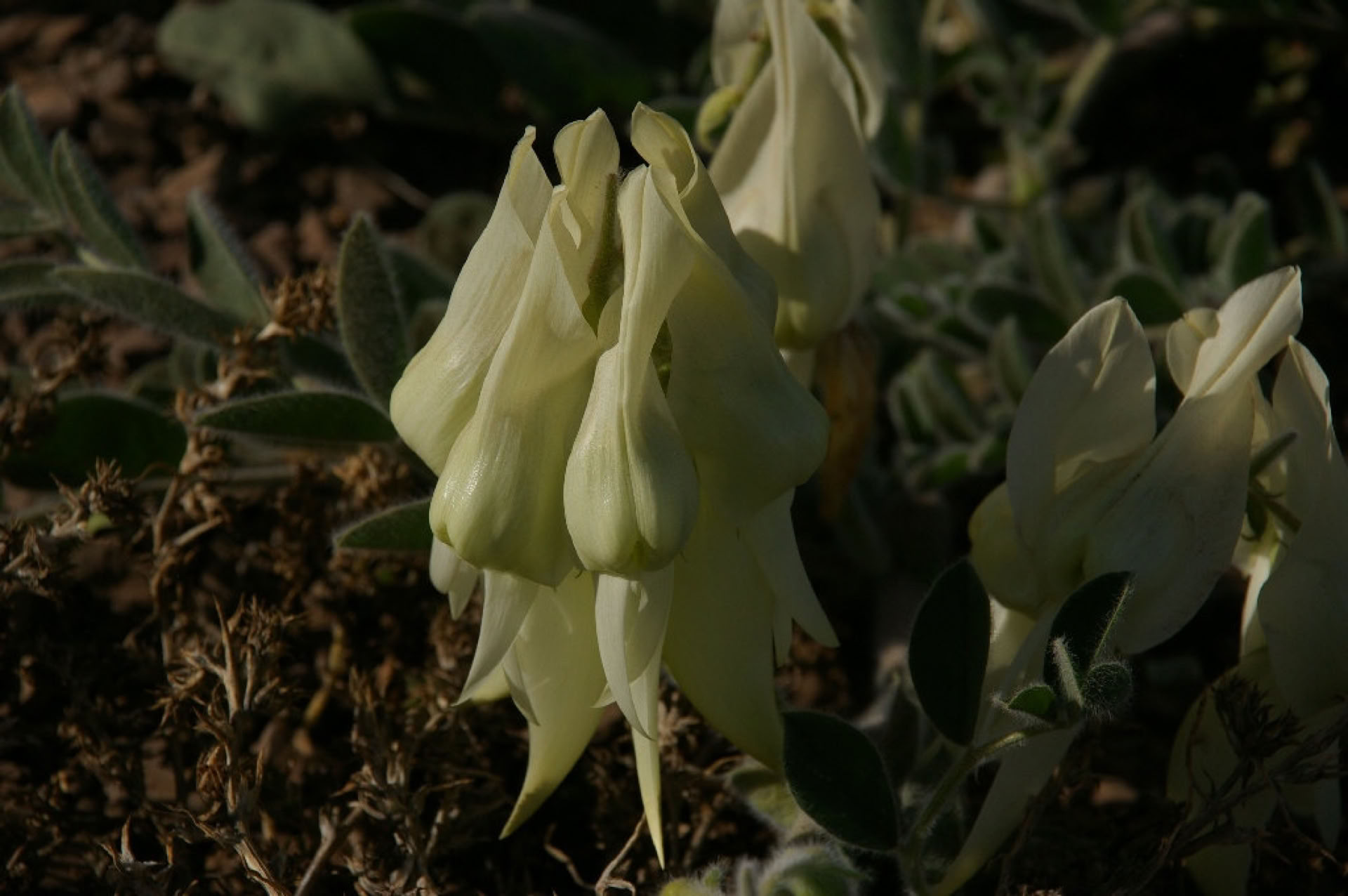
04/10/2010 Wildflowers currently at their peak!!!!!
With the weather patterns returning to sunny spring days, plants of the outback are quick to develop their flowers. There has been and still is so much Sturt Desert Pea to be seen in the northern Flinders and beyond. The White flower (pic below) has since wilted. We are being spoilt with the 3 beautiful colours of the Darling Pea (Magenta, Burnt Orange and Vivid Yellow) quite often carpetting the landscape. In parts of the Southern and Central Flinders Ranges the Salvation Jane has reached one metre tall and in full flower providing a carpet of purple. The Butterfly Bush has just started to flower. If you are thinking of coming to the region I would suggest the sooner the better as the day temperatures will soon be reaching 30 deg c plus. We operate our tours all year and look forward to hearing from you in the near future. Regards Paul Keen
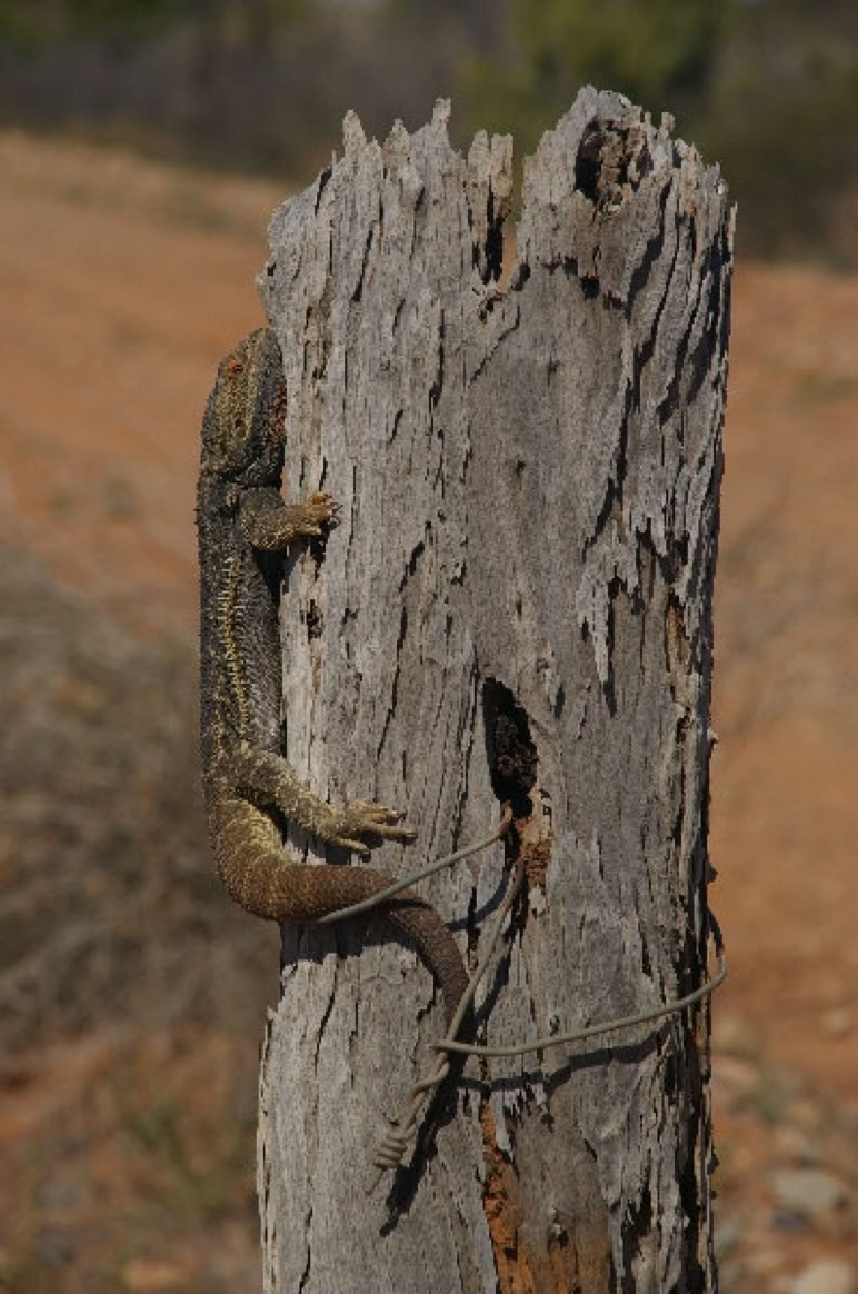
Below is a recent pic of a Bearded Dragon soaking up the sun. Gammon Ranges National Park.
05/09/2010 One week on and yes "More RAIN" spread accross the outback.
Whilst attending the opening of the 9th Painters of the Flinders Ranges exhibition held annually in the Wilpena shearing shed I had the opportunity to take a few photos for you to enjoy.
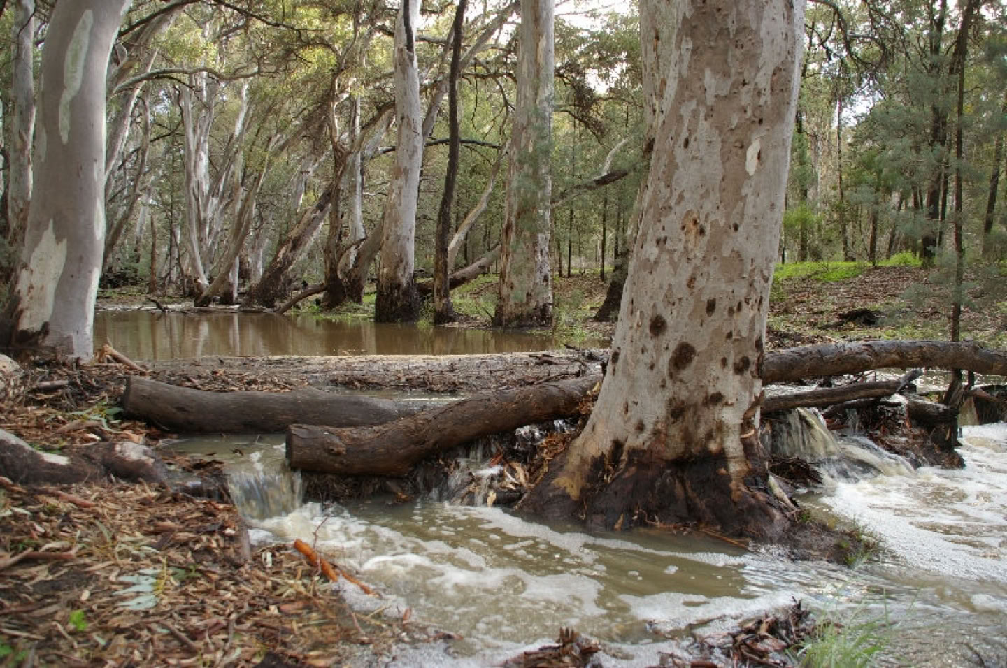
The wonderful sight of Wilpena Creek flowing.
Arkaba Creek with a break in the clouds highlighting Rawnsley Bluff.
Elder Range touching the clouds
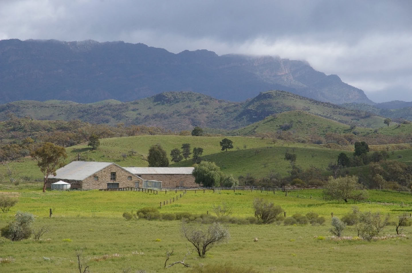
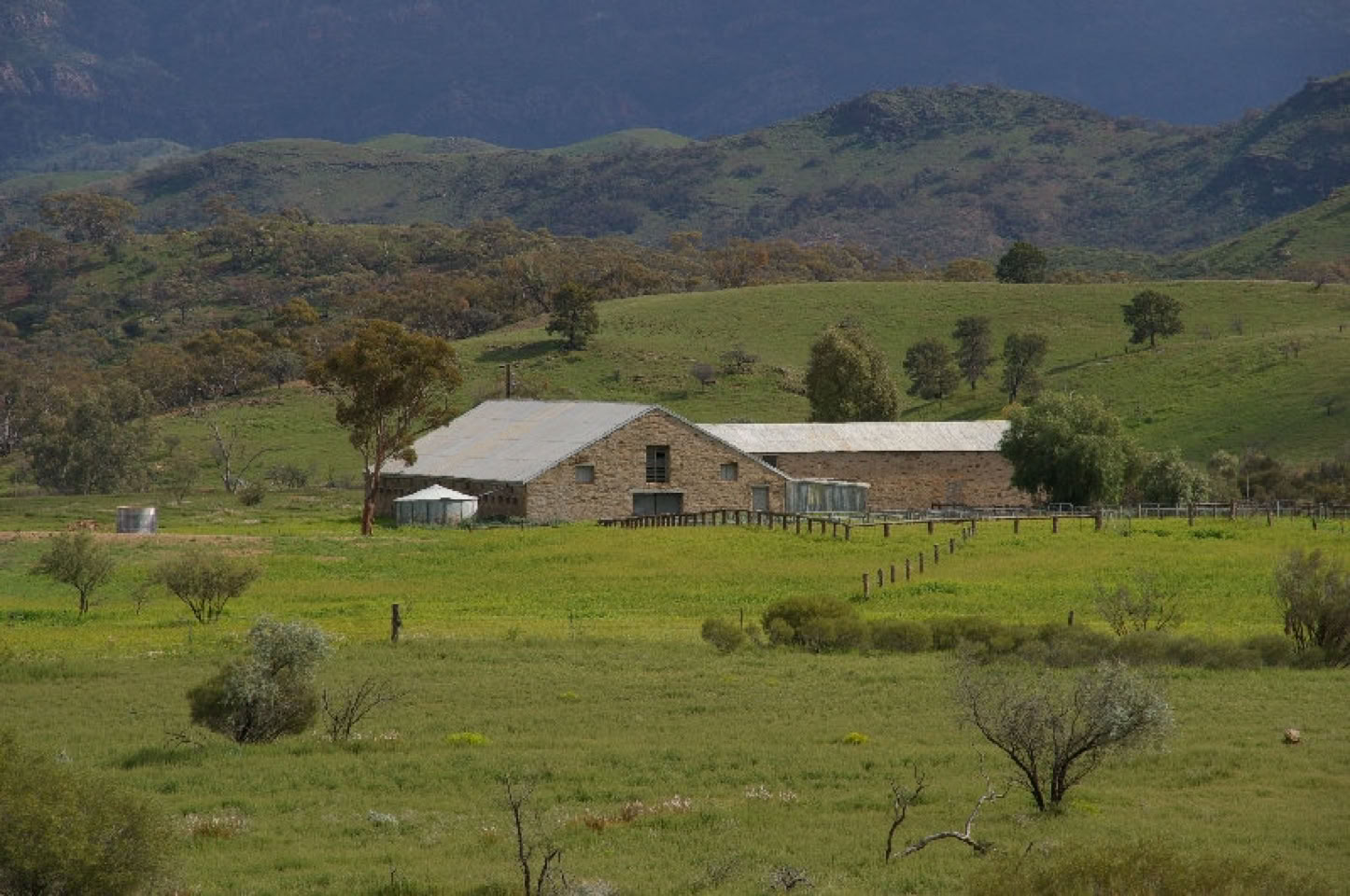
Arkaba Woolshed c1856 (allways a delight to photograph)
02/09/2010 Small change to the Lake Eyre itinerary
For maximum passenger comfort whilst on tour during this Spring and Summer we have removed the 1 night of camping to include an accommodated Station Stay in a self contained Overseer's House at Muloorina Homestead.
We will provide sunset nibbles and drinks at the edge of Lake Eyre North's Level Post Bay and cook a healthy stir fry back at our accommodation.
24/08/2010 More RAIN falls on Outback South Australia.
Thankfully this week I am performing vehicle maintenance, as the outback roads I regularly use are all CLOSED for a few days due to approx. 2 inches of rainfall over the weekend.
The News has reported 70 travelers stranded at William Creek on the Oodnadatta Track and 40 travelers at Mungarannie half way along the Birdsville Track.
The birds and wild flowers haven't had it this good for nearly 20 years.
I've heard that Anna Creek Station (Australia's largest cattle station) has an annual rainfall of 3 inches is currenlty well above 7 inches to date.
I am in the process of developing a new tour itinerary to include a visit to the Coopers Creek and joining an Eco-cruise
with long time Coopers Creek cruise operator, Peter Ware.(pic below)
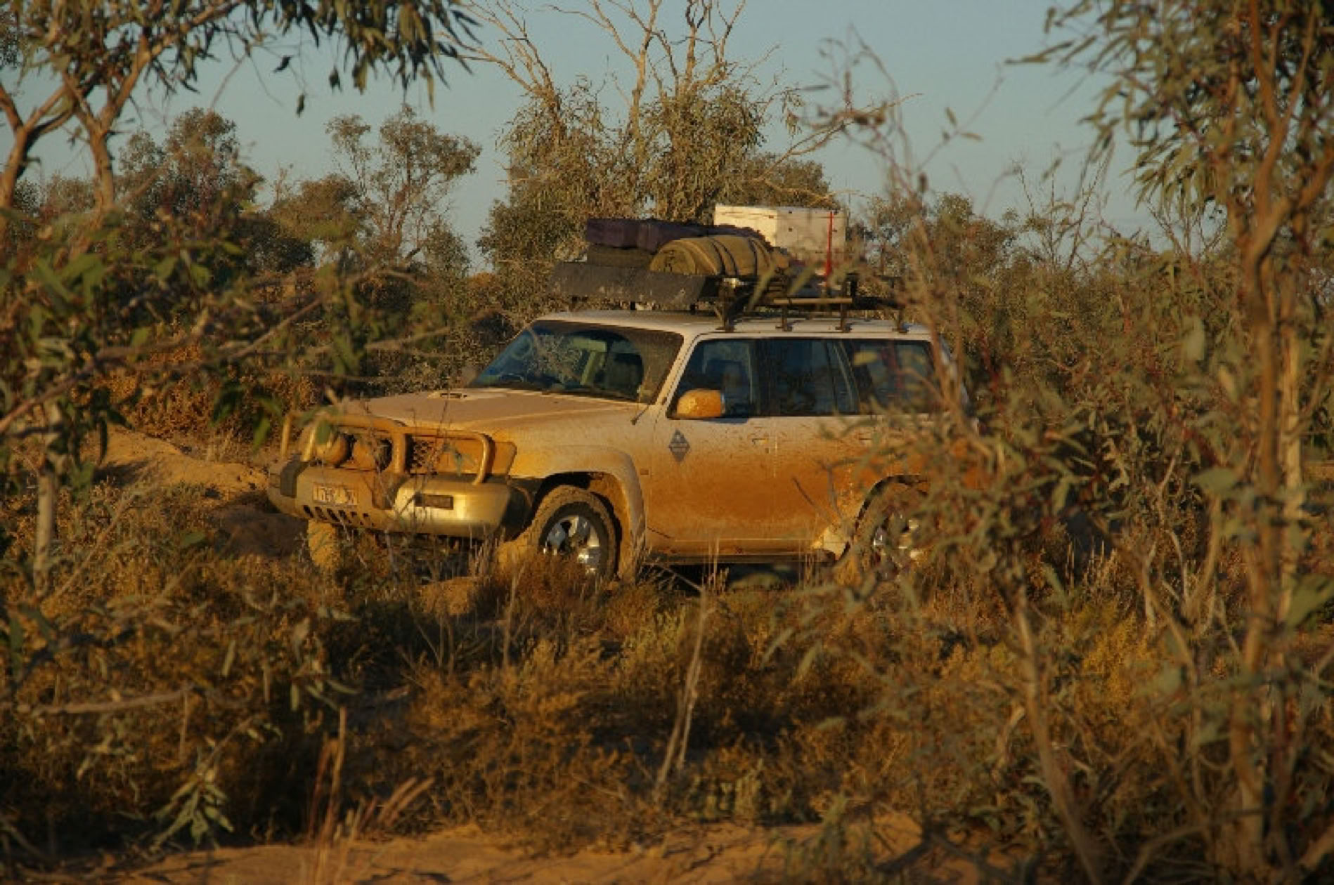
P.S. I have just purchased a brand new Nissan Patrol and will be operating with 2 4WD tour vehicles for the next 6 months so I can cater for groups of 8 or run 2 different itinerarys at the same time.
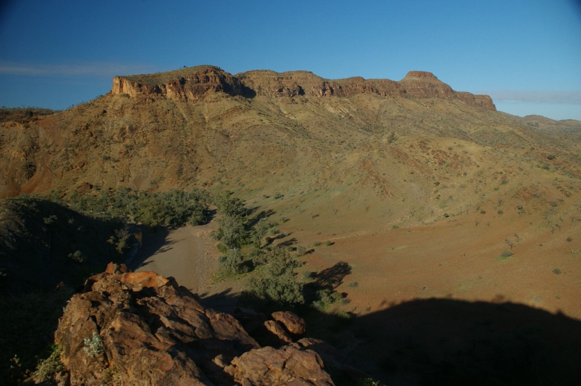
18/08/2010 The region is looking FANTASTIC.......
All I can say is, this must have been how the early settlers saw the Flinders Ranges and Outback region in the 1800's to think they could possibly grow wheat crops and graze sheep and cattle this far north.
The emu chicks have hatched early this year. (first sighting 26th July) The Shingleback and Bearded Dragon Lizards are waking up and becoming active on a warm day.
31/07/2010 My latest adventure
was a 9 day bird watching tour of the Flinders Ranges, Coopers and Warburton Creeks via the Birdsville Track and Lake Eyre North via the Oodnadatta Track. Whilst we were at Wilpena Pound one to three inches of rain fell accross the region above the outback town of Marre making the outback roads impassable. We soon had a rethink of our itinerary to spend a day at Arkaroola Sanctuary whilst the wind and sun dried the dirt road surface to make them passable to 4WD vehicles.
BIRD SIGHTINGS LAKE EYRE / FLINDERS RANGES - July 2010
Plus numerous other LLB’s., LGB’s (with yellow rumps) Ducks++++
The pics below are from this tour. I will tell more of this amazing adventure when I have more time.
Coopers hues awaiting our arrival
Last crossing for the day (74 vehicles)
"Our turn"
Coopers Creek Discovery Cruise guided by Peter Ware (excellent)
Q: We're driving through THAT???? A: Yes
Warburton Creek, Cowarie Station, Thank you Sharon....
Our trusty safari vehicle.....
Days end on the banks of the "Warburton".... Cheers Ladies
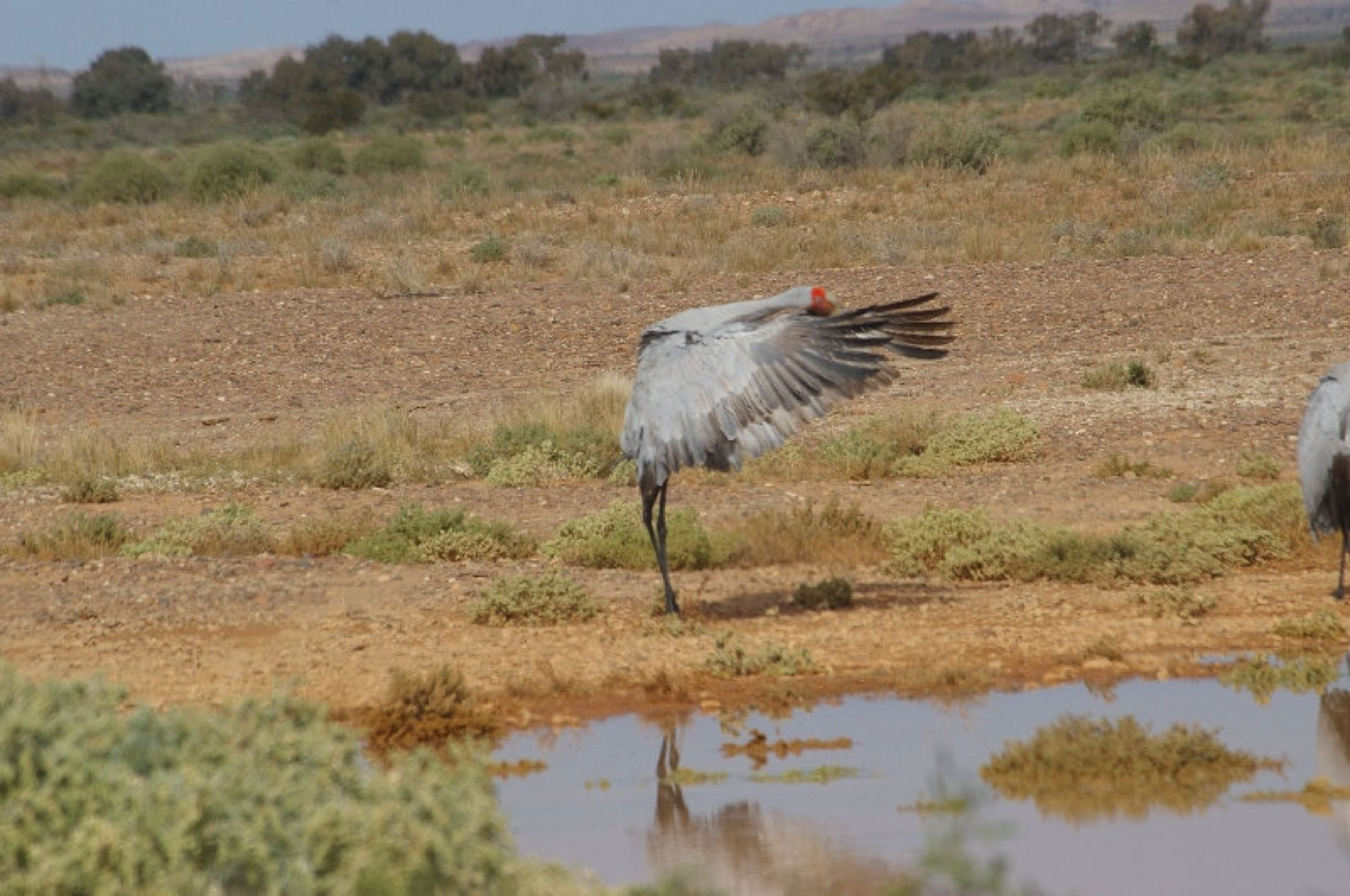
Brolga dancing beside the Oodnadatta Track.
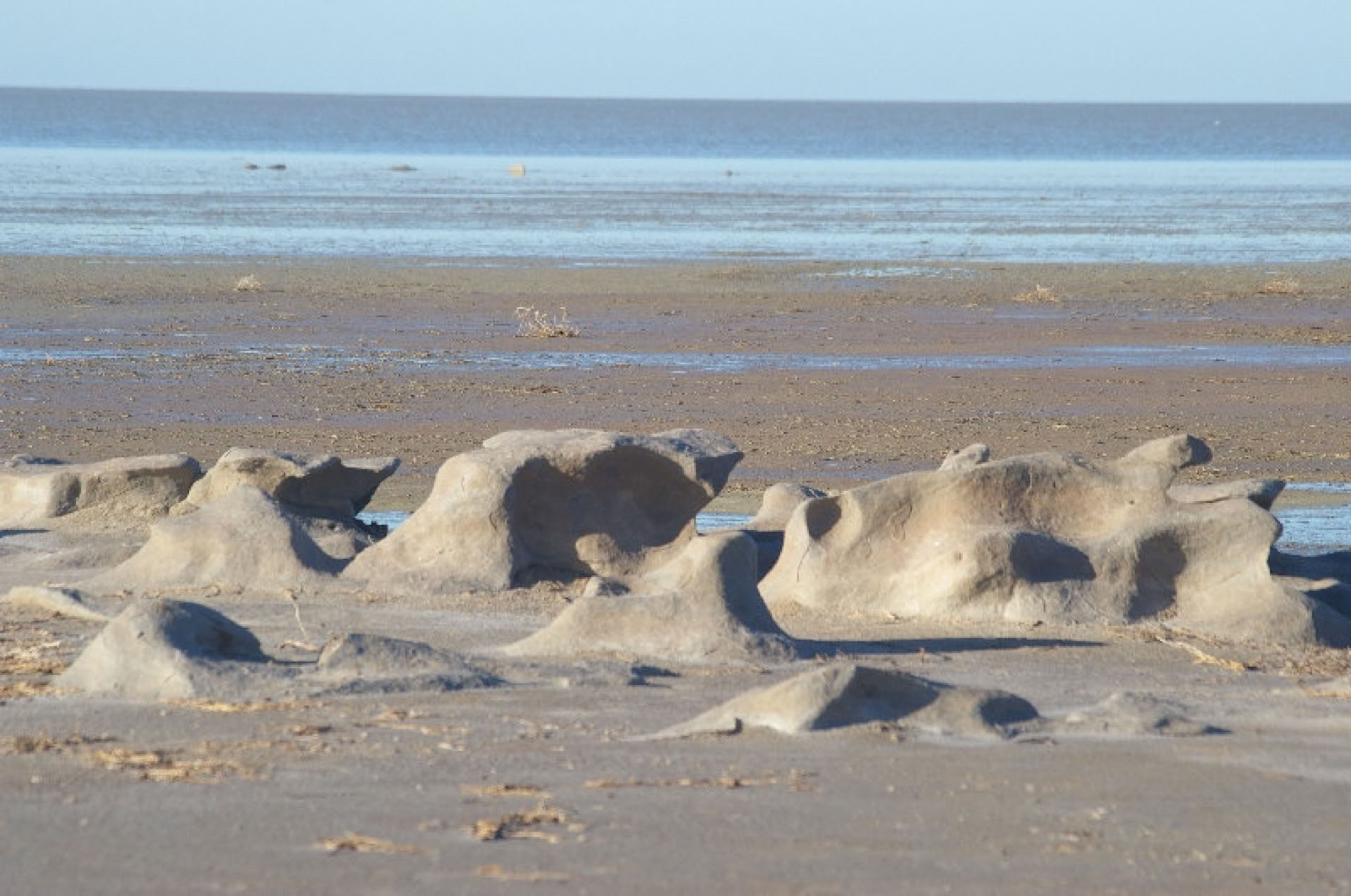
Sculptured by nature...
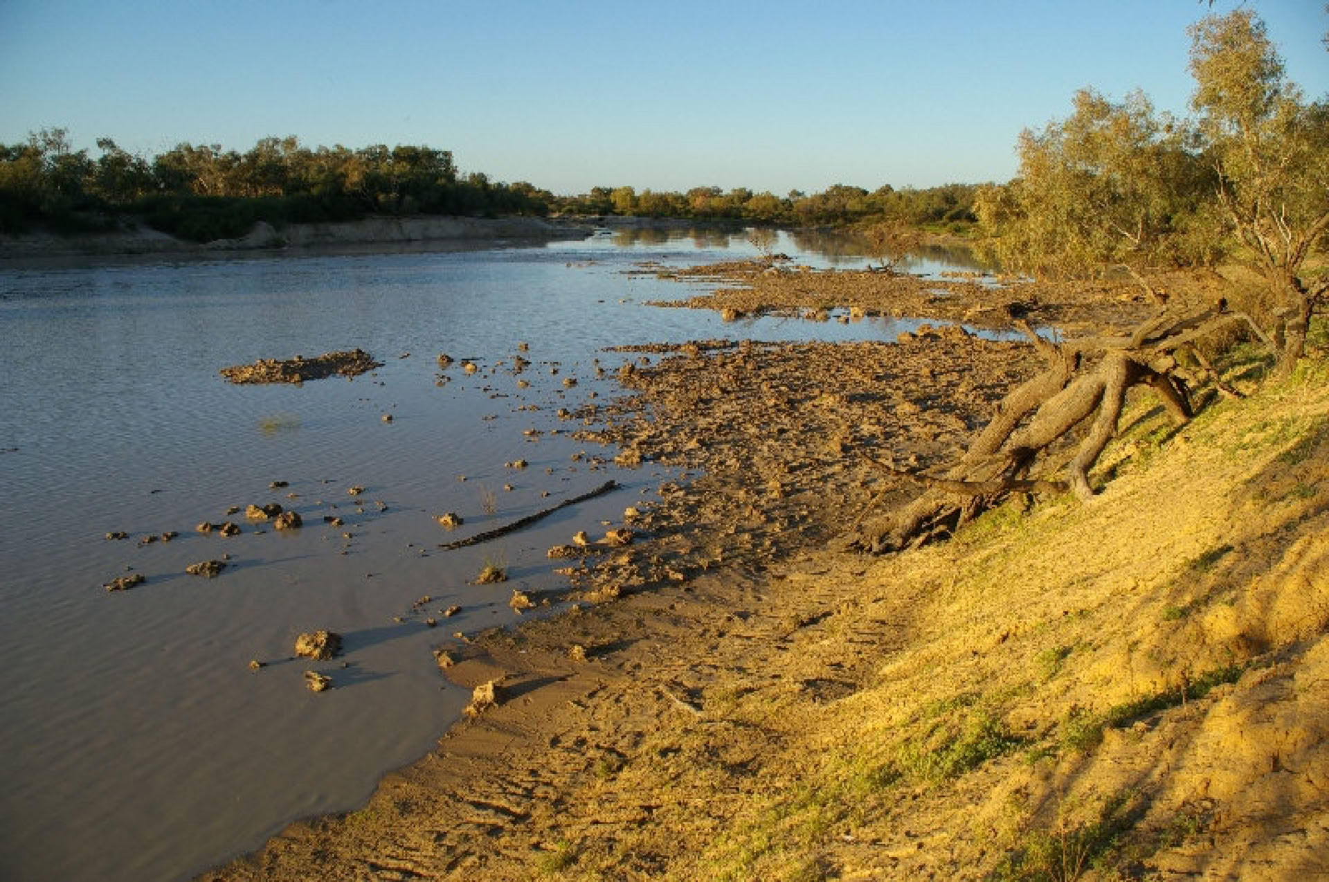
10/07/2010 The water level in Lake Eyre Northat the Halligan Bay access point has been stable for the past 3 weeks. Flood waters from the Coopers Creek entered Lake Eyre North on Tuesday 29th June. Hopefully water from the Coopers', will fill into Level Post Bay (Wallaby Tracks sunset dinner location) part of Madigan Gulf via Marree.
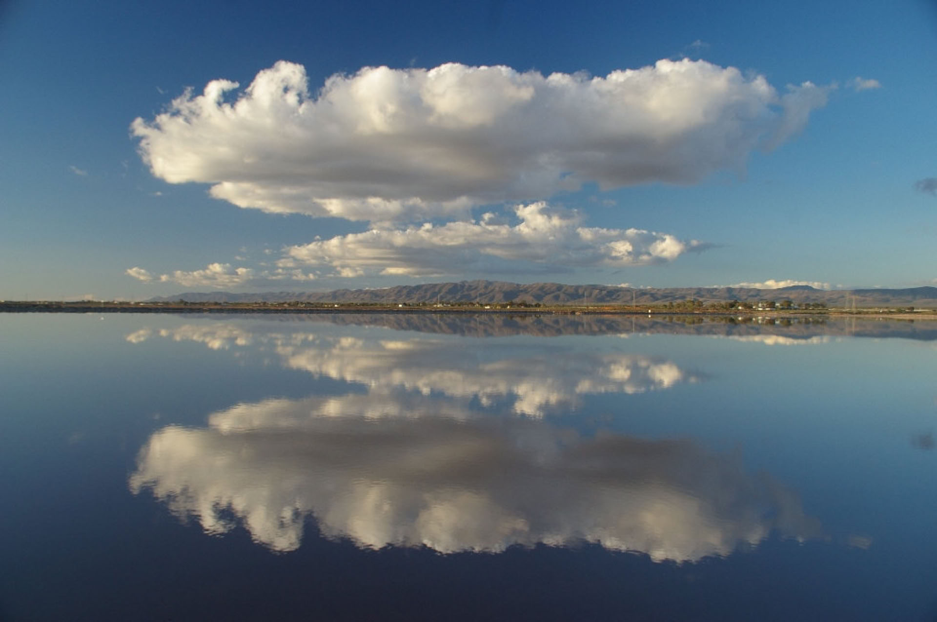
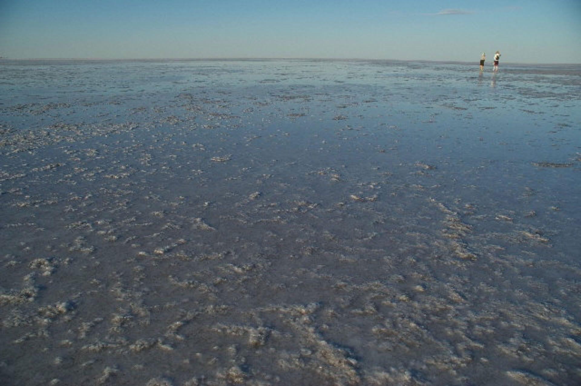
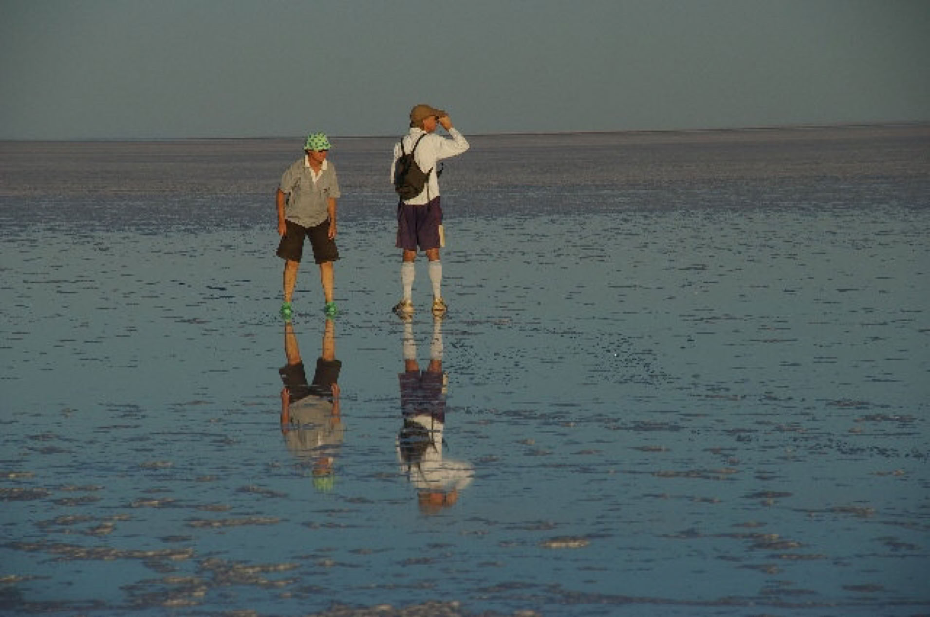
Amazing reflections - Halligan Bay - Lake Eyre North - 01/07/2010
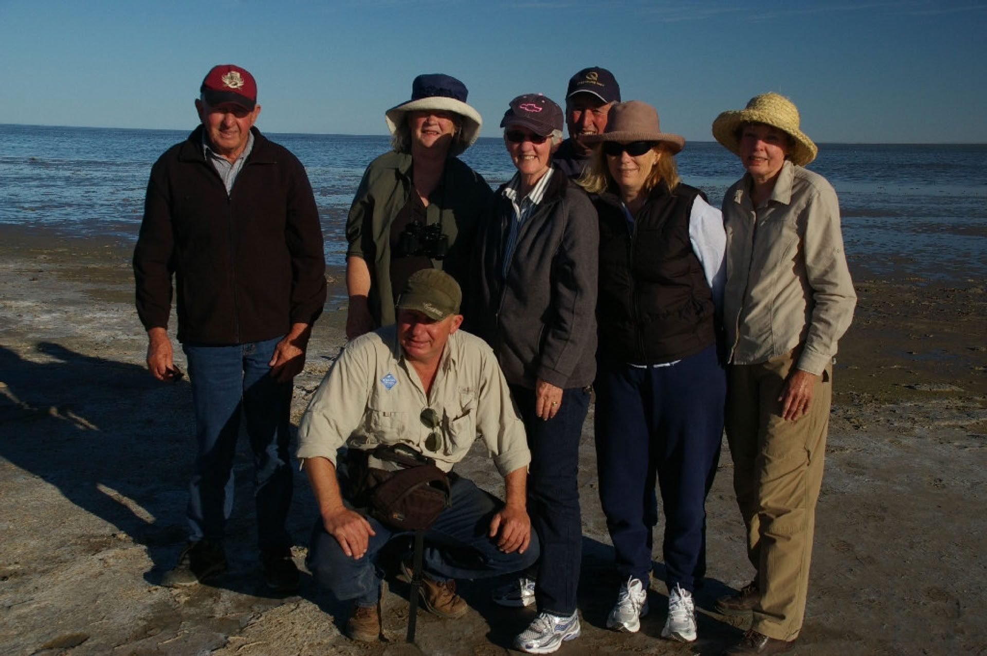
Team Wallaby @ Halligan Bay, Lake Eyre North
19/06/2010 WALLABY TRACKS first tour to Lake Eyre for 2010. (guest comment "absolutely amazing" Thank you Paul and Gary)
After an early set off from Adelaide we travelled express to the French Bakery cafe in the main street of Port Pirie. A great coffee with fresh pastries was enjoyed by all.
After travelling between the colourful sedimentary layers of Port Germein Gorge to step up to the Southern Flinders plateau it was time for a leg stretch and look around the historic township of Melrose. The Austral Hotel at Quorn provided a first class lunch. From here the group grew from 5 to 8 as 2 guests chose to have Quorn as their starting point and we were also joined by my 2nd guide (Gary). The afternoon was filled with 2 nature walks. The first was in search of the endangered Yellow Footed Rock Wallaby, we were successful with a sighting and had a bonus of the brilliantly coloured Red Capped Robin. Paul carries with him an Audubon bird caller which he tweets to attract various birds to appear from out of nowhere. Next stop we reminisced of the hardship our early settlers had to endure by visiting the extensive remains of Kanyaka Homestead ruins. Our fitting finale of day one was a 1 hour nature walk to the aboriginal art site of Arkaroo Rock. During this walk we witnessed the changing red light of the lowering sun against the Chace Range.
Halligan Bay, Lake Eyre North 17/06/2010
Day 2 was a day of mainly walking and exploring Wilpena Pound and the Flinders Ranges National Park. We spotted another colony of Yellow Footed Rock Wallabies, some healthy bush bananas in fruit, marine fossils dating to an astonishing 530 million years old just to mention a few highlights of the day. We had a great night of fine food and good conversation at the Prairie Hotel, Parachilna.
Day 3 everyone was excited about their scenic flight over Lake Eyre which had been extended to 2 hours to be able to witness the massive front of FLOOD waters flowing in the COOPERS CREEK toward Lake Eyre and see the old vehicle punt on the BIRDSVILLE TRACK in use. After lunch we drove the 50km to set up our water front campsite before 4WDing to Level Post Bay, Lake Eyre North for a walk and SUNSET dinner (amazing pic coming soon) Yes, there was the perfect amount of cloud cover to provide a spectacular sky show during pre dinner nibbles. We had a mild night temperature wise, great for camping.
Day 4, whilst Paul and Gary were packing everything up everyone was ordered to go and enjoy the many bird species who make the wetlands habitat their home, spotted were a whistling kite, cattle egret, white faced heron, crested pigions and many more. After a quick visit to the Lake Eyre Yacht Club we headed west for William Creek in time for lunch before making our way over kilometres of corrugated dirt road to reach Halligan Bay on Lake Eyre's western side to be able to witness and touch water in Lake Eyre by land. (pic above) We had the whole lake to ourselves. An early dinner at the William Creek Hotel with a night drive accross to Coober Pedy to our very clean and comfortable accommodation at the Opal Inn Motel.
Day 5, after refuelling the vehicles while our new friends looked at opals we had the long drive to Adelaide in front of us. A pair of keen eyes spotted a vibrant area of STURT DESERT PEA on the side of the Stuart Highway. We arrived back in Adelaide approx. 7.30pm and said our goodbyes :^(
Thank you for travelling with Wallaby Tracks, Regards Paul Keen
RARE white Sturt Desert Pea, near Wearing Gorge. Northern Flinders Ranges
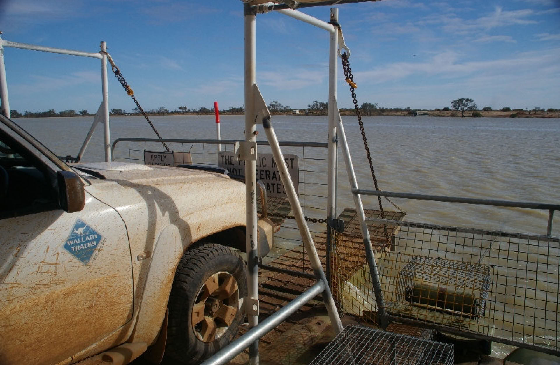
11/06/2010
After gentle winter rains the Flinders Ranges and Outback regions of South Australia are building up to a wonderfull wild flower season. The punt (ferry) crossing the Coopers Creek on the Birdsville Track is now operating after lying dormant for approx. 20 years. One vehicle at a time...... Be prepared to wait awhile to cross........
This coming Monday 14th I start the first of my 2010 Lake Eyre & Flinders Ranges tour packages. I will give a full report upon my return. Below are 2 recent tour photos, Mount Chambers (taken during our 2 hour nature walk), View of the Emeroo Range taken from National Highway 1, near my home town of Quorn.
I am currently doing a few tours to Arkaroola which is in full flower with 2 areas of Sturt Desert Pea on show and the Pink Mulla Mulla and red Rosey Dock are at their current best. If you have any questions please send me an email. I look forward to hearing from you. Regards Paul Keen
02/05/2010 ** Bookings filling **
Several of my departure dates have filled. The Birdsville Track has re-opened and it is predicted for the Coopers Creek to cross the Birdsville Track in June after filling Lake Hope.
New to the WALLABY TRACKS fleet is a beautifully restored 1928 Model A Ford Phaeton Tourer which has been over the Government pits and passed with out question. It now boasts its new chauffeur number plates 1762SV and is ready for touring the Clare Valley wine region and loves being highly polished for her wedding and special occasion duties.
"The Calm before the Storm."
26/03/2010
The future of Outback tourism is unpredictable this year with regards to the forcast number of visitors to witness water in Lake Eyre for the second year running after the visitor frenzy of 09.
Having met many dissapointed visitors on "other" tours during 09 who saw No water from the land I will continue to include a visit to both Lake Eyre land access points as part of my standard tour itinerary and my truely memorable 3 course SUNSET DINNER on the edge of Lake Eyre at Level Post Bay.
Below is a recap of how Lake Eyre took on water in 2009 with a hypothetical prediction for 2010.
24/02/09 ~ 15/03/10 Flow started into Warbuton Groove of Lake Eyre
23/04/09 ~ 12/05/10 (59days) Water coverage of Lake Eyre accessible on foot at Haligan Bay (400m)
07/05/09 ~ 26/05/10 (15days) Water coverage PEAKED to within 100m of the shoreline at Haligan Bay
01/06/09 ~ 20/06/10 (26days) Water level remained stable before starting to diminish.
Please visit my Lake Eyre tours ex. Adelaidelink to read about our exciting 2010 Lake Eyre experience.
We look forward to receiving your enquiries, Regards Paul Keen
P.S. As there is a shortage of good accommodation in the Outback it pays to book as early as possible.
FLOOD ADVICE FOR COOPER, STRZELECKI AND WARBURTON CREEKS
Issued at 12:45 pm on Thursday, 25 March 2010
1. FLOOD ADVICE :
COOPER CREEK SYSTEM
River heights in the Cooper Creek between Nappa Merri, Qld, and Innamincka, SA, are falling slowly. At Nappa Merri the river is at moderate flood level. At Innamincka the level is above 10m and water continues to flow into Strzelecki Creek. The Cooper Creek is still flowing west across the Strzelecki Desert. Strzelecki Creek headwaters are nearing Lake Blanche. Creek levels between Cullyamurra Waterhole and Innamincka are expected to gradually ease over the coming week.
DIAMANTINA-WARBURTON SYSTEM
At Birdsville the Diamantina Creek flood level is falling slowly but remains in the moderate flood category. Flood waters continue to rise along the South Australian section of the Diamantina/Warburton Creek. Low flows are reported into Lake Eyre. Floodwaters from Queensland are anticipated to flow into the lake in approximately 3 weeks.
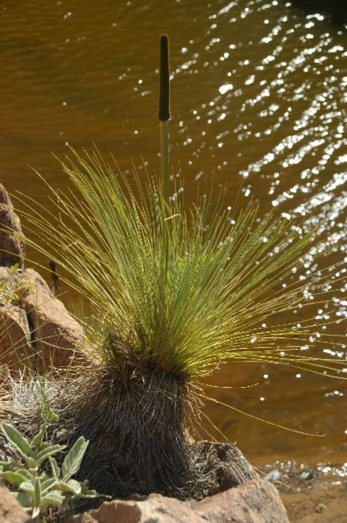
Below are my 3 photos of the month. Pastures on the Frome Plains ~ Perfect grass tree silhouette, Arkaroola Waterhole ~ Creek crossing Gammon Ranges National Park.
15/02/2010
It has certainly been a long hot summer. With very few bookings due to the extreme outback heat I decided to go on holiday myself to research the tourism industry in New Zealand for 3 weeks. I hired a small rental car and pre booked modest motels for my journey of the north and south islands. Some highlights were a helicopter flight to land on the top of FOX GLACIER, a thrilling jet boat ride to the base of the HUKA FALLS at Taupo, a morning boat cruise of the MILFORD SOUND with the water like glass and a very bumpy cruise in and around the BAY OF ISLANDS.
I have returned with some new business ideas and a renewed enthusiasm for the region that I am so devoted to. New Zealand was great BUT there was mass tourism where ever you visited, the complete opposite of what I have to offer i.e. When on tour we have the whole Flinders Ranges to ourselves and it becomes a treat when we see other human beings.....
To help kick start the new year I am offering a 10% DISCOUNT on all accommodated tours from our brochure. This offer is valid until 31st MARCH 2010.
18/12/09
Firstly the team at Wallaby Tracks wish to pass on warm Christmas wishes to everyone from the Flinders Ranges.
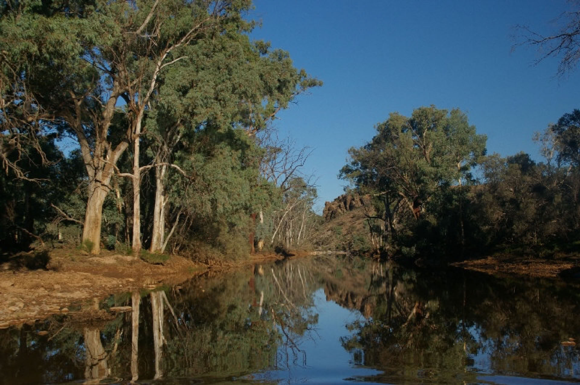
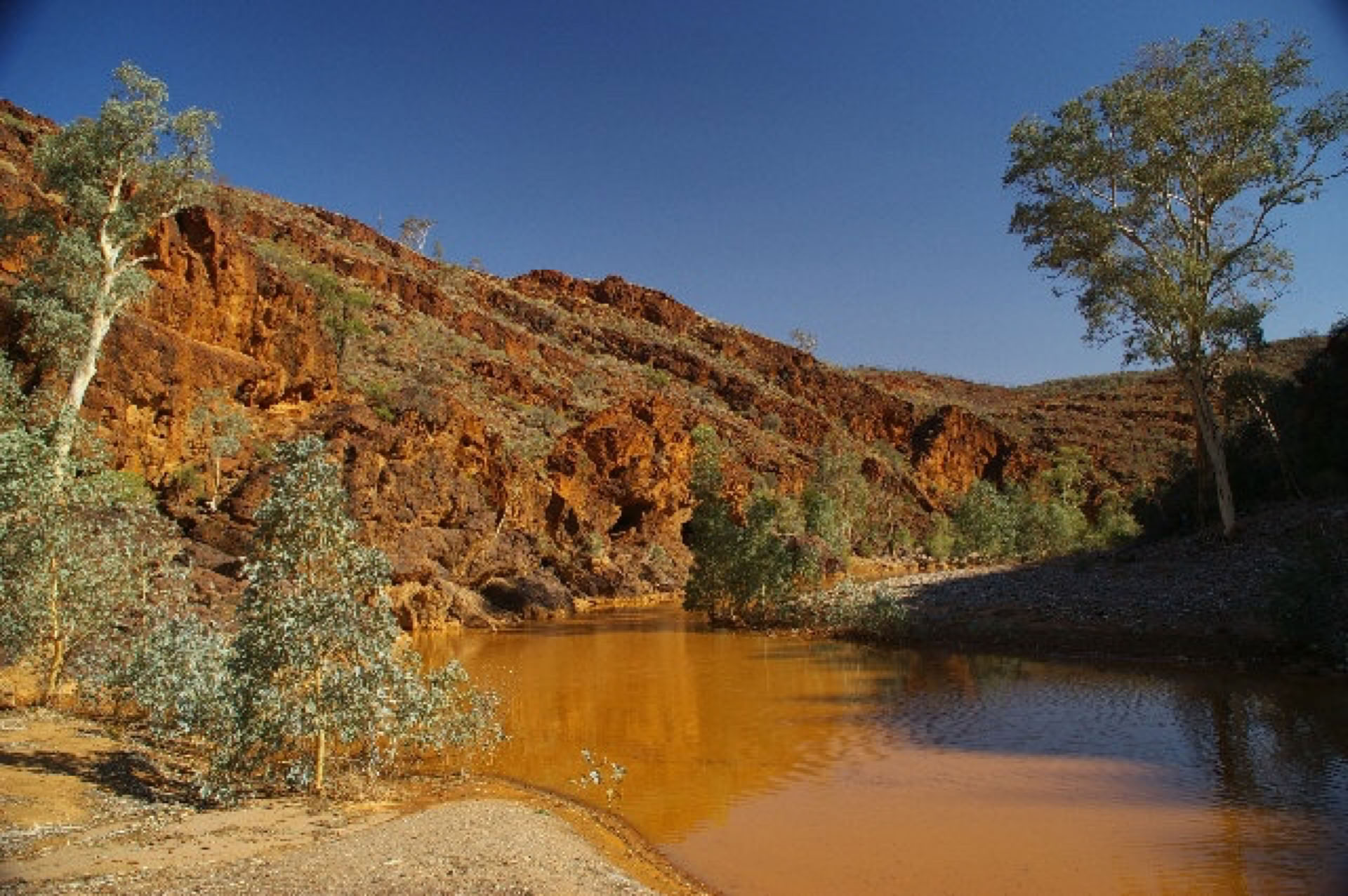
We have received some recent thunder storms over the region which have made dry outback creeks flood and have made some outback roads in the region closed for up to 2 weeks due to water erosion. Some flowers have thought that it is Spring once again and have started to flower for the second time. Waterholes throughout Arkaroola Sanctuary are currently full and looking spectacular.
Pictured below are two of my favourites. (left) Stubbs Waterhole (right) Nooldoolnoodoona Waterhole.
14/10/09 **
As you can see it has been quite some time between my regional updates.
I have been kept very busy over the past 7 months observing the rise and fall of the waters within Lake Eyre North. Certainly an experience I will keep for many years to come.
The wild flowers have also reached their peak and have started to develop their new seed pods. With great seasonal rainfall this year I have been spoilt to be able to view some flower varieties for the first time. Most exciting was one small area of wild orchids which were only on display for a short time.
At the moment the annual grasses are starting to turn golden as Summer approaches. We have experienced many huge dust storms over the past 2 months, the winds are that strong the dust is carried all the way to Sydney.
18/07/09
Water still visible from the western shoreline via William Creek.
Lake Eyre Youtube Video On Tuesday 14th July I took a scenic flight over Lake Eyre North to be amazed with the speed in which vast areas of the very shallow areas of the lake have become vibrant white salt crystals again. Don't be alarmed though, we still flew over huge areas of water complete with white caps as there were 40 knot winds at ground/water level. The level of water in Jackboot Bay has remained unchanged for many weeks as it it is a long and narrow bay which isn't affected by the strong winds.
Closer to home, the Southern and Central Flinders Ranges are vibrant green, The crops are looking very healthy, the golden balls of wattle are bursting open daily, the grivilleas are heavily laiden with flower buds. If you were ever thinking of a visit to the "Flinders" I wouldn't put it off any longer.
White = High water mark, now salt again, Blue water top = Jackboot Bay
11/06/09
The question of the week is how quickly will the lake evaporate???????
I will be back at lake Eyre this coming Friday after 12 days between visits. This will give a good indication of what to expect. Meanwhile I have been away on a bushwalking tour of the Flinders Ranges. Due to early winter rainfall the southern and central Flinders are looking fantastic with a vibrant green colour added to the multitude of amazing colours the Flinders provides for the photographic eye.
01/06/2009 *** LAKE EYRE update ***
"The TIDE is TURNING"
After retaining a constant water level for the past 4 weeks my last visit was showing signs that the tide is on its way OUT. As it is unknown how quickly the water will recede I have gone to the trouble to organise a second tour guide and vehicle to travel together offering an extra 4 seats (2 seats remaining) for the following departure 25th June 2009
Overlooking Elliot Price Conservation Reserve
I was going to offer some accommodated tours but after looking into availability of rooms to find there was a lack of, I thought I would concentrate on what I know best. Good old BUSH CAMPING.
Below is our revised tour now known as the 5 Day Flinders Ranges and Lake Eyre Experience (visiting Lake Eyre from its 2 vantage points and allowing time for a scenic flight)
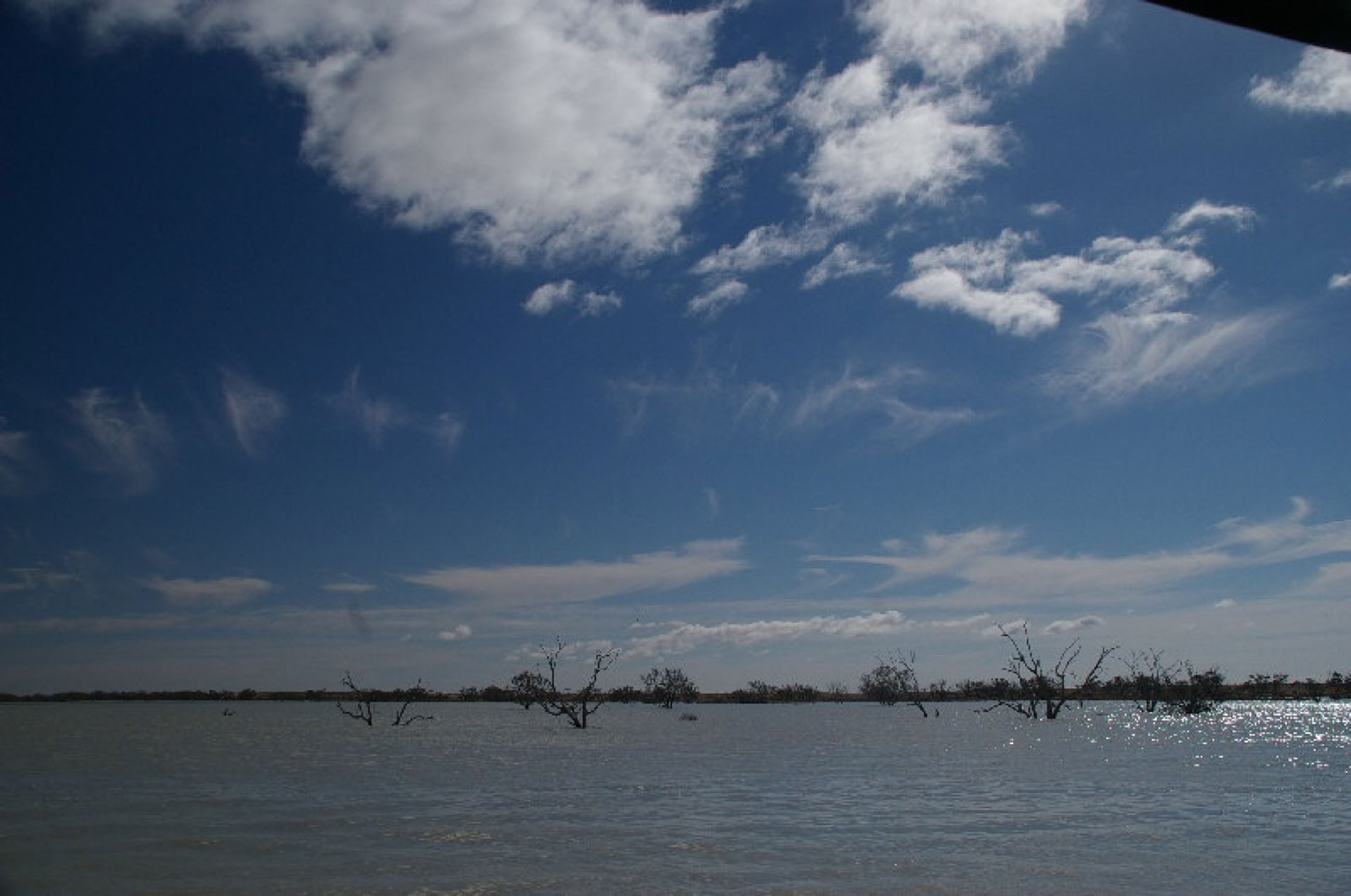
You can see by my new picture below how far out the water line is from the shore at Haligan Point. less than 100m.
There were about 20 seagulls present during this visit with some Pelicans being sighted from the scenic flight making their home on Silcrete Island.<
Below are some fresh photographs (22/04) from the first of many 5 Day Flinders Ranges and Lake Eyre Experience.
Unfortunately no pics from the wonderful scenic flight. Having fully charged my camera batteries before leaving on tour I deliberately didn't use the camera until the flight over Lake Eyre North, however whilst on the plane I took 3 shots as we flew over the dry Lake Eyre South then the unthinkable happenned.... Yes FLAT batteries :^(
From the air we saw the South eastern section of Lake Eyre North including Jackboot Bay ( which had only filled a only a few days earlier), Silcrete Island, Belt Bay and Haligan Bay. We could see in the distance the water was about to enter the top of Madigan Gulf. I can't wait until my next flight (With fresh batteries) to assess the new water coverage since my prevoius visit.
It is still too early to witness any birdlife in mass numbers.
The pics below are from Haligan Point (western side L.E.Nth.)
Lake Eyre North is still filling slowly.
Please visit this link to view the satellite picture on the Lake Eyre Yacht Clubs web site.
http://www.lakeeyreyc.com/Status/latest.html
Current view Lake Eyre North - Level Post Bay (left - centre) Fresh camel tracks (right)
Unspoilt tracks (left) Lonely tour vehicle (centre) White faced heron at campsite (right)
"Advertiser newspaper" Saturday 11th April 2009
** TIDE FLOWS IN THE GREAT OUTBACK SEA ** by Clare Pedde
Flood water from Queensland is spreading across the surface of Lake eyre at a rate of 1m per every minute and waterbirds are chasing it across the landscape.
Prospect resident Rob Crichton,54, timed the flow of water as it moved past his feet during a visit to Lake Eyre this week.
Mr. Crichton walked into the middle of the North lake as it was filling up.
" It was a very significant moment really,because it has probably only filled up maybe three or four times in the last 100 years," he said."I'm not sure if it will have enough water backing it upto fill the whole lake,the North and the South, but give it another few weeks and it will be interesting to head up there again."
Bird expert Professor Richard Kingsford of the University of NSW, said the area was about to "go off" with more than 60 species of waterbirds known to be heading south to the basin.
"Birds will be on the move in the next month or so," he said.
"After eight years of drought the spectacle will be fantastic."
UPDATE:27/03/2009
It has just passed the first month of flow of flood waters into Lake Eyre from the Warburton Creek.
Two weeks ago the bureau advice stated that “water will continue to flow into Lake Eyre for several months”.
I’m afraid it has now been down graded to “Water will continue to flow into Lake Eyre during April”.
There has been talk that it will only reach approx. 30% capacity.
I will be at Madigan Gulf, Lake Eyre North via Muloorina Station on 8th April to see what the situation is first hand.
I have also heard from a local pilot that the birdlife is confined to a couple of islands that have formed.
As I do not wish to take anyone on a tour with false expectations, (e.g. the water to be lapping the shoreline) I would still encourage taking a tour during this mild time of year and include a scenic flight over Lake Eyre to view this spectacular event from the air.
I am completely booked for the month of April with Flinders Ranges Tours and have availability from Friday 8th May for tours to Lake Eyre from 3 days duration Ex. Adelaide to a 5 day Flinders Ranges and Outback experience.
I take bookings on a first come basis, so if you have a preferred departure date please let me know early to avoid disappointment.
Keep an eye on our website www.wallabytracks.com (DEPARTURE link) as we will be posting – when/where future tour dates and what seats are available.
I will be posting another update upon my return on 14th April 2009
Have a great day.
Regards Paul Keen
Wallaby Tracks Adventure Tours
MOB: 0428 486 655
AUSTRALIAN GOVERNMENT - BUREAU OF METEOROLOGY
SOUTH AUSTRALIA REGIONAL OFFICE
FINAL FLOOD ADVICE FOR INLAND RIVERS
Issued at 1:35 pm on Thursday, 26 March 2009
1. FLOOD ADVICE :
Water continues to flow into Lake Eyre via both the Warburton Groove and the Kalaweerina Channel. The Warburton Groove and the Kalaweerina Channel are now full and water is spreading out across the lake floor. Water continues to flow into the lake from Warburton Creek and Kallakoopah Creek.
Upstream in Queensland, water levels in the Diamantina River at Birdsville and Eyre Creek at Glengyle have fallen below Minor flood level.
Water will continue to flow into Lake Eyre during April.
---------------------------------
25/02/09 Todays "Hot Topic" is LAKE EYRE...
Approximately one month after the huge North Queensland floods these waters have continued to flood anything that crosses its path as it makes its journey along the Diamantina & Warburton Creeks to flow into the almighty Lake Eyre.
The 24th of February 2009 was a very important day as it marked the start of the 2009 filling of Lake Eyre.
Wallaby Tracks have already had quite a number of enquiries regarding tours to Lake Eyre once it has filled sufficiently to warrant a visit.
If you are interested in possibly joining a tour and would like to be kept informed of Lake Eyre's progress please send us a short email stating your preference of an accommodated or camping style tour.
The Summer rains have arrived with avengance. Recently the Northern Flinders Ranges including Arkaroola Wilderness Sanctuary have received approx. 2 inches of rainfall to make the normally dry creeks to FLOOD leaving the previously dry waterholes filled to their limit..
17/11/08
The Spring rains are becoming less frequent now. The once green annual grasses are now a rich gold in colour and present a high fire risk due to their dry nature.
The wildflowers have left us for another year :^(
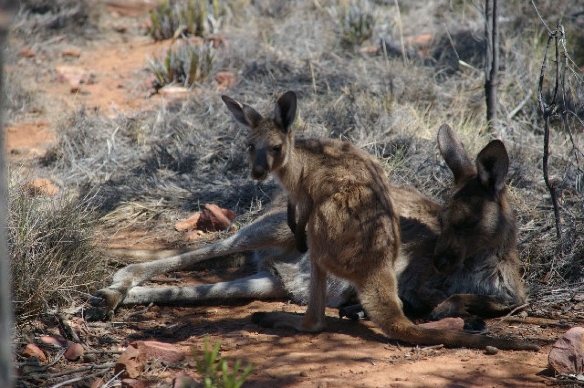
The kangaroo numbers are on the increase as they migrate back to the Flinders Ranges for their summer. As kangaroos are creatures of habit, the same kangaroo lays patiently under the shade of the same native pine tree whilst the heat of the day passes. They also use their sharp claws of their forehands to dig a small depression in the ground so they can lay on their hip and so they can have maximum contact with the cooler ground surface.
Tourist numbers to the region are becoming less as the daily temperatures increase, so if you can tolerate our dry heat you will be almost guaranteed to have the whole Flinders Ranges to yourself and I'd be happy to be your guide.